When we think of spring in Scotland, we don’t often associate it with wild fires – yet surprisingly the months between March and June are the most likely to see our hills, forests and moors ablaze than any other time of the year.
Despite our often wet winters, the combination of dead and dried out heather, leaves and grasses, and strong, drying winds in spring can spell disaster if a stray spark or cigarette finds its way onto the land. Once ignited, these fires can be very difficult to put out, not only damaging the landscape but also putting firefighters’ live at risk and threatening people, wildlife and property.
In 2023, it was reported that there was at least one fire every day between March and June – over a third of them in the Highlands. Since then, there have been a number of initiatives to identify the best ways to avoid wild fires. This is why Peatland ACTION is keen to highlight the role peatland restoration can have in preventing their spread. By rewetting the land, restoration makes it much more difficult for fires to start, or to spread across them from elsewhere.
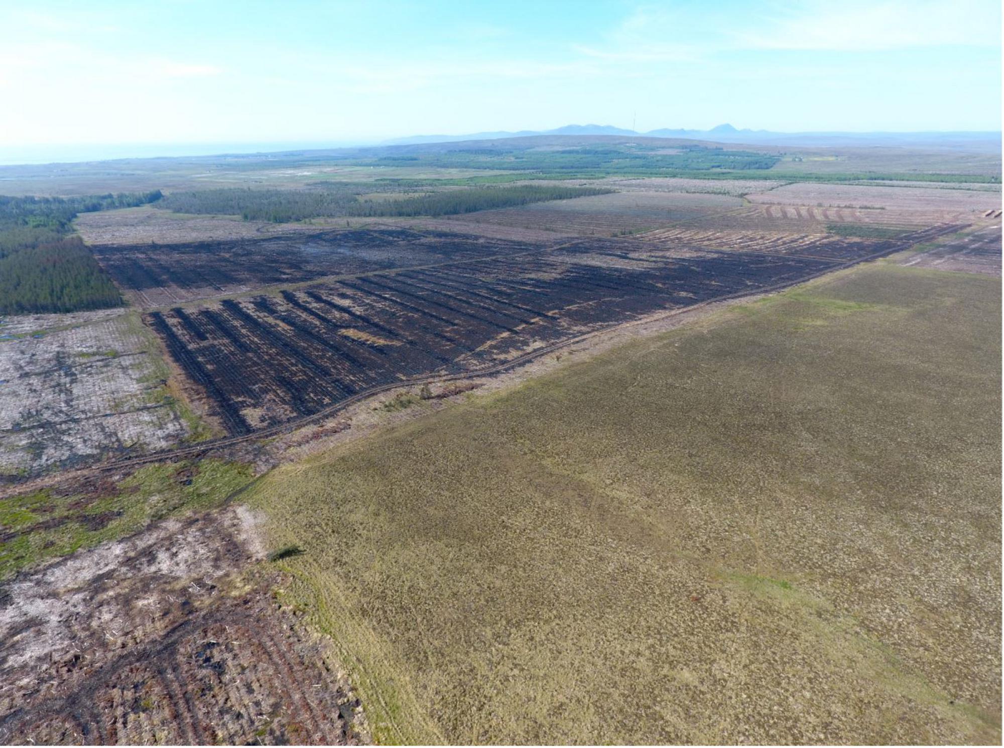
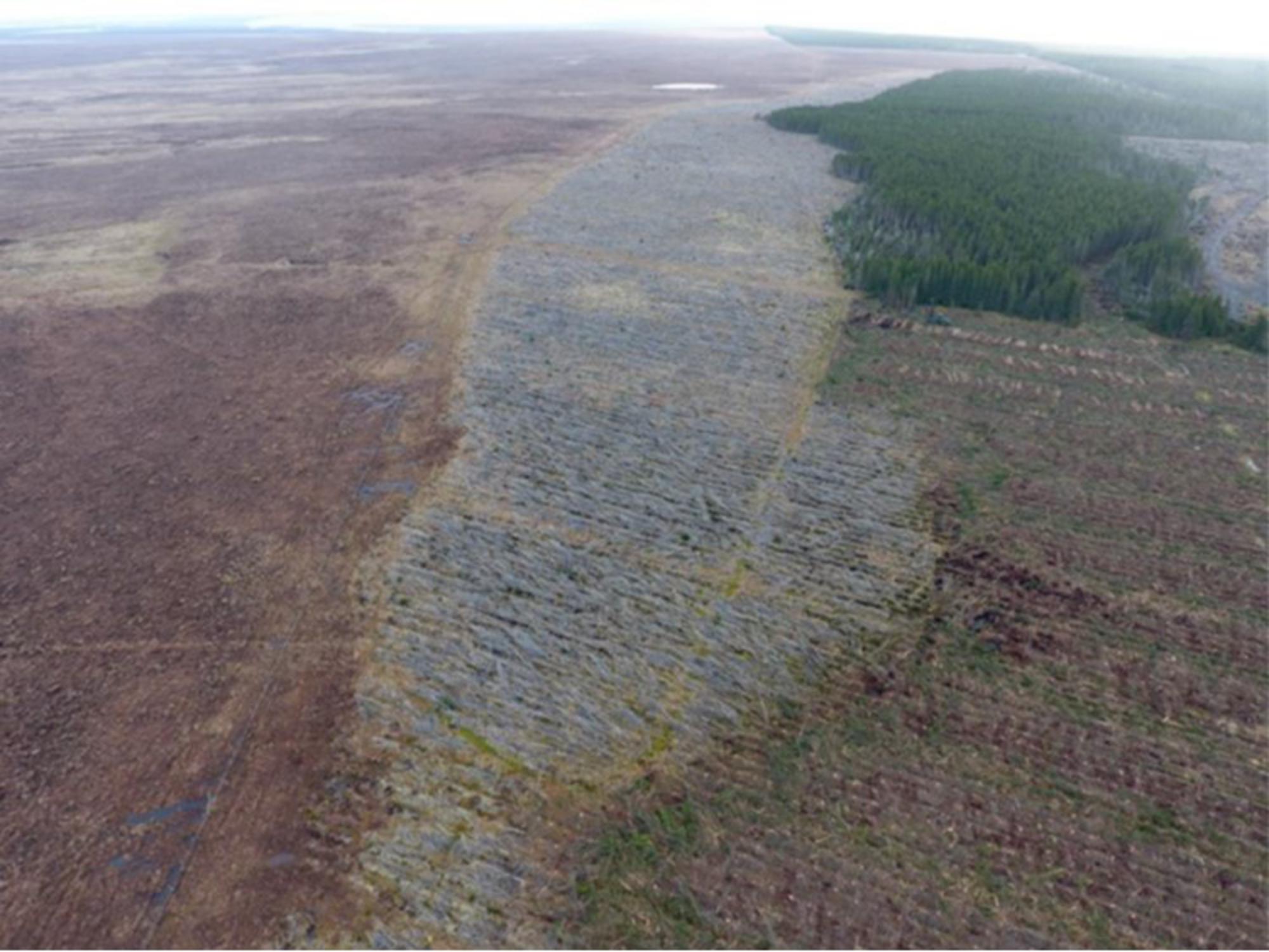
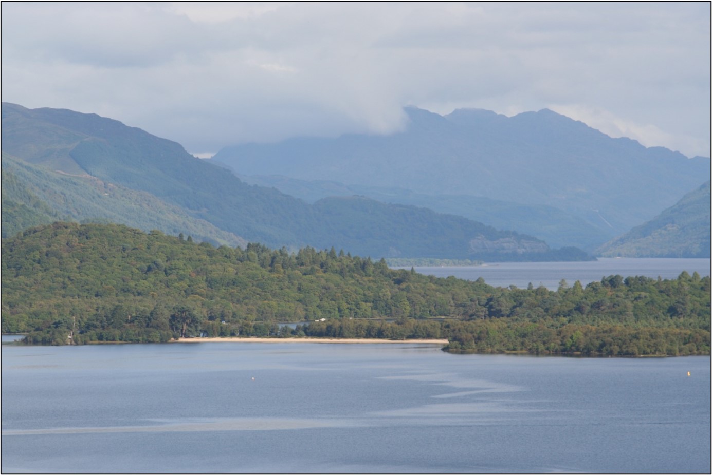
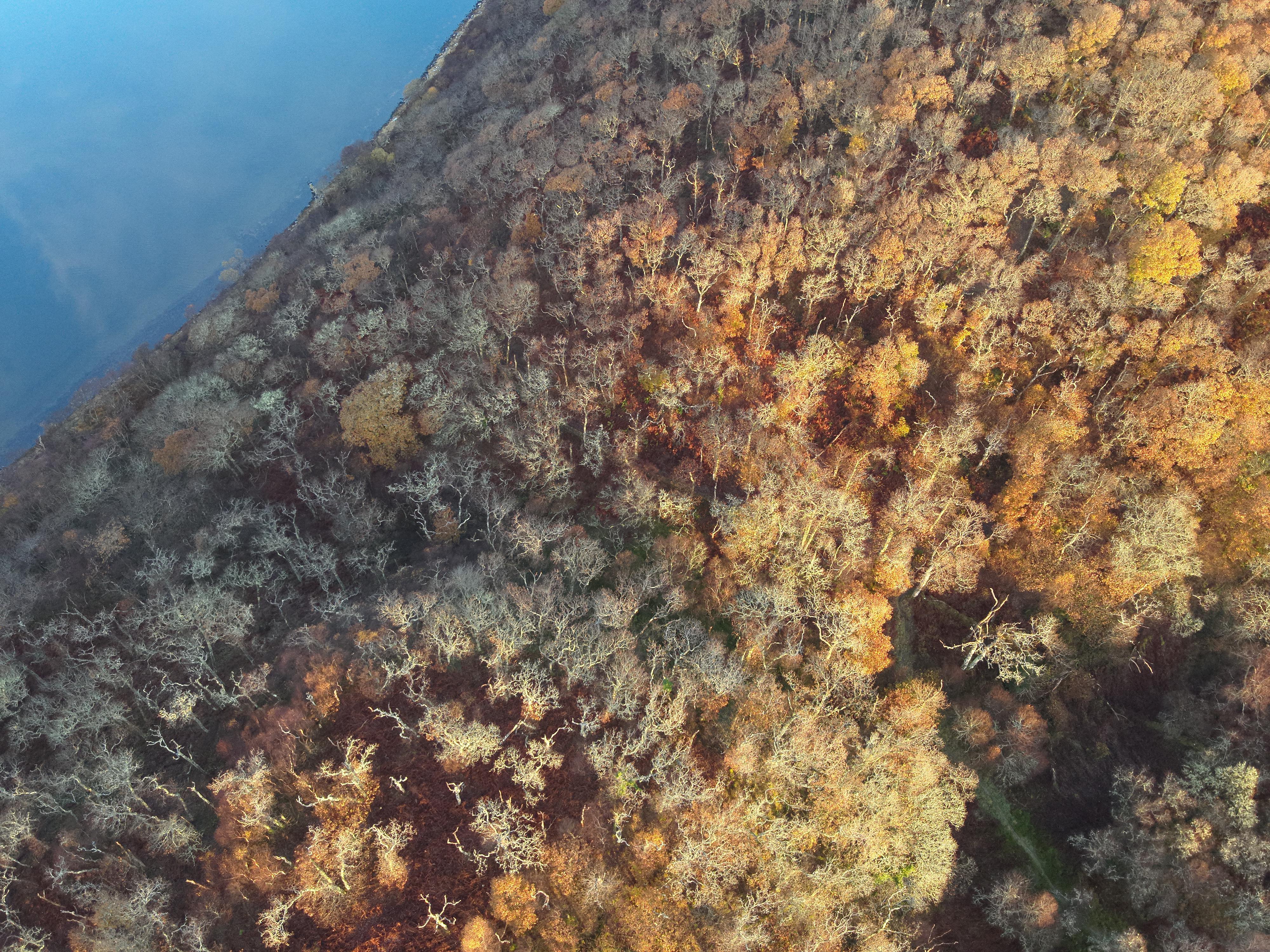
When fire took hold across the forestry and moors above Lybster in Caithness in 2018, it burnt everything in its path – until it came to the recently restored peatland at Golticlay. The work here to smooth out the furrows and ridges left in the peatland after the forestry had been removed raised the water table. This meant the ground surface and vegetation were too wet for the fire to spread. It was a dramatic example of healthy peatlands’ ability to prevent the spread of wildfires.
The combination of the wetter surface, thanks to the higher water table, an increase in peatland vegetation, and the removal of scrub on the areas where peatland restoration work had taken place stopped the fire in its tracks—with the stark line between scorched black and lush green clear to see from the air. You can read the full case study on the Peatland ACTION website.
Peatlands in good condition are one of the most robust open habitats found in Scotland’s landscape, along with other wetlands. However peatlands that have been damaged, for example where drainage has been installed, are likely to suffer more severe fire damage and spread fires to neighbouring areas. They usually support the growth of heathy or grassy vegetation, increasing the amount of fuel available and drying out the layer of peat nearest the surface.
This evidence is more than anecdotal. The Fire Blanket project, a research programme led by a team from the University of Highlands and Islands from 2019-21, compared the fire resilience of blanket bogs under different management regimes using measures of vegetation, moisture, peat properties, satellite-derived “bog breathing” and water quality.
They used a major wildfire that happened at Strathy, in the Flow Country, in 2018 as the study site. The project concluded that ‘restoration is likely to increase wildfire resilience and reduce wildfire severity. This in turn should help minimise the carbon losses and biodiversity impacts associated with these events.’
Of course, in an ideal world we wouldn’t have these fires in the first place. Most of them are started either accidentally or deliberately by people, and by following a few simple guidelines many of them can be avoided. If you are out in the countryside, please follow Scottish Fire and Rescue Service’s guidance https://www.firescotland.gov.uk/outdoors/wildfires/wildfire-prevention/
Follow the Scottish Outdoor Access Code’s advice and never start a fire when a wildfire danger assessment is in place and during prolonged dry periods in areas such as forests, woods, farmland or peaty ground.
Don’t have BBQs on any flammable surface during very dry and prolonged weather. Instead have them within safe designated BBQ areas.
Don’t have campfires or any outdoor fire when a wildfire danger assessment is in place or during prolonged dry periods.
Always fully extinguish cigarettes and dispose of them responsibly.
Don’t leave litter; take it home with you and leave no trace. Glass in direct sunlight can cause a fire. Ensure none is lying around.
Where possible, use a stove rather than an open fire.
If you do light a fire, keep it small, controlled and supervised.
Make sure the fire has been fully extinguished and remove all traces of an open fire before you leave the area.
In his short life (1766-1802), Thomas Garnett, a native of Westmoreland, achieved a substantial amount. In addition to being a member of a number of learned societies in Scotland, England and Ireland, he became a Professor of Natural Philosophy and Chemistry in the Royal Institution of Great Britain and was highly regarded as a lecturer. His importance, in a Scottish Gaelic context, lies in his authorship of a two-volume work called ‘Observations on a Tour through the Highlands and part of the Western Isles of Scotland’. He was a close observer of the Highland scene and in his introduction, he explains that his approach as an author was to entice readers ‘from the straight path of the tour, to take a glance at the secret operations of Nature, and that the slight taste which they would thus have of her dainties, might give them a relish for a more sumptuous repast.’
His work was not without controversy, as he wrote of the ‘wretched situation of the inhabitants in the Highlands’ but he claimed that his intention was to ‘increase the comforts and remove the distress of the natives’. He recognised that his honesty would give offence to some persons, particularly ‘those who have it in their power to ameliorate [the Highlanders’] condition’.
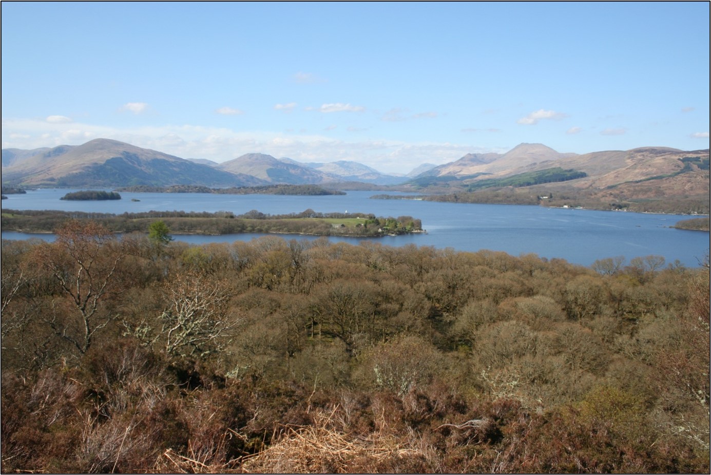
Garnett left Glasgow on the 9th of July 1798 and headed first down the Clyde and north to Loch Lomond. In this blog I shall look at his comments about Loch Lomond and, most particularly, the names and characteristics of its beautiful and unique freshwater islands.
Garnett and his companion, a young gentleman artist ‘Mr Watts’, first encountered a Loch Lomond island close to the village of Luss, where they visited the Rev. Dr. John Stuart, ‘a man of great taste and learning’ who was engaged in the translation into Gaelic of the Old Testament (his father having superintended the translation of the New Testament a generation earlier). Stuart had a superb garden that lived up to the name of his adopted village (the name Luss coming from the Gaelic lus ‘plant’). Garnett was impressed by the fact that the churchman had planted his garden with many rare species, including native alpines from all over the Highlands and Islands.
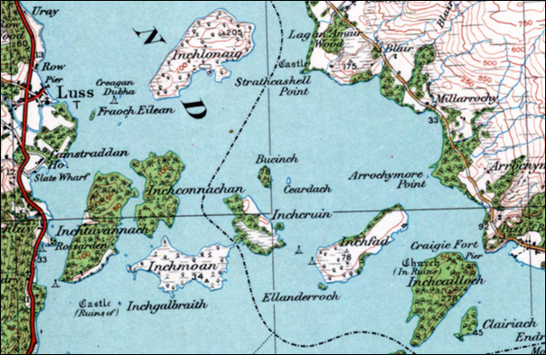
Stuart organised a boat and boatman for Garnett and Watts to be taken out to Inchtavannach, the closest major island to Luss which is in extent about 150 acres and was at the time uninhabited and covered largely with ‘wood and heath’. Garnett correctly interprets the name of the place as ‘the island of the monk’s house’ – no doubt under the guidance of the scholarly minister. In Gaelic this is Innis Taigh a’ Mhanaich. It is connected in tradition to St Kessog.
A gathering of innis island names (usually anglicised ‘inch’) near Luss on Loch Lomond. Clairiach at bottom right is a typographical error for Clairinch, given as Clairinish (Clàr Innis ‘flat island’) on modern maps. Reproduced with the permission of the National Library of Scotland
The highest point of the island – Tom nan Clag ‘the hill of the bells’ – provides a superb viewpoint and from it Garnett was able to spy virtually all of the many islands in Loch Lomond. To the south was Inchmurrin, upon which only a gamekeeper and his family were then resident. This is Innis Mearain ‘the island of St Mirren or Mirin’, a 6th century churchman. In Garnett’s time it was owned by the Duke of Montrose, although he notes that the island boasts the ruins of an old castle which was once a ‘habitation of the Earls of Lennox’. To its north-east is a chain of four islands of which the furthest east is Inchcailloch which Garnett correctly translates as ‘isle of Nuns’ (Innis Cailleach). It is connected to St Kentigerna (died 733 AD) who had a nunnery there, and it was once a burial place of the MacGregors. As well as being well wooded (which it still is), the island was inhabited in Garnett’s day and produced good crops of wheat and oats.
The reader who has some familiarity with the Gaelic landscape will have already noted that the default generic for ‘island’ in Loch Lomond is not the common eilean of the more modern era, but an older word – innis – also used in Irish Gaelic and which has a Welsh cognate – ynys. While pronounced ‘IN-eesh’ in Gaelic, it is generally anglicised ‘inch’ in Scottish place names. In Loch Lomond, as evidenced by the island names, we are dealing with an unapologetically old Gaelic landscape. This is compounded by the fact that some of the islands bear a largely unfamiliar word order, where innis is terminal rather than initial. The three other small islands at the southern end of the loch are Creinch (Craobh Innis ‘tree island’) which was covered with an oak wood in 1798 (Garnett gives its name as ‘Grange’, showing the pronunciation but failing to recognise the etymology of the name), Torrinch (Tòrr Innis ‘hill island’) and Clairinch (Clàr Innis ‘flat island’); the last is given as Inch-Clear i.e. Innis Clàir by Garnett, demonstrating a more ‘modern’ word order than exists on the current OS maps.
Garnett makes interesting observations about a tiny islet near the mouth of the Endrick Water at the south-eastern extremity of Loch Lomond. On modern maps it is named Aber Isle but he gives it as Inch-Aber i.e. Innis Abair ‘river-mouth isle’. Garnett claims aber as a Gaelic word, rather than recognising its origin in the P-Celtic Brittonic language but this is perhaps understandable, given the construction of the toponym (and, no doubt, following advice from the Rev. Stuart). It is possible that aber was loaned into Gaelic and became active within the language for a period, although the place name scholar W.J. Watson tells us that ‘it does not occur in Gaelic literature or in common speech [and] appears to have been displaced at an early stage in the language by the purely Gaelic term inbhear.’
The term inbhear (or, more commonly inbhir) does appear in one of Loch Lomond’s islands – Inveruglas Isle at the northern end of the loch. This is named for Inveruglas or Inbhir Dhubh-ghlais ‘mouth of the dark stream’ on the adjacent mainland shore.
To the immediate north of Inchcailloch is Inchfad which is Innis Fhada ‘long island’ (it is rather long and narrow). Five ‘innis’ islands stand between Inchfad and Inchtavannach. There is Inchcruin or Innis Cruinn ‘round island’, reputedly named for a rounded peninsula on its eastern side. In Garnett’s day it was largely unwooded and housed an ‘asylum for insane persons’. To its immediate west is the broad island of Inchmoan or Innis Mòna ‘peat island’, long a source of domestic fuel for the people of Luss and the surrounding area. North of this is Inchconnachan or Innis Chonachain ‘Colquhoun’s isle’ which was ‘covered with oak and fir’. The other two islands in the group are Bucinch (Boc Innis ‘buck [goat] isle’) and Inch Galbraith, a tiny crannog (artificial island) which supported a medieval castle owned by the Galbraiths.
To the north of these islands, immediately east of Luss, is the large island of Inchlonaig which has a fascinating history and ecology. Garnett noted that it contained ‘above 150 acres, one-half of which is covered by a natural wood of old yews, some of them very large. When bows and arrows were in use, this island was of great value, and the trees were preserved with the utmost care.’ Oral tradition tells us that it was King Robert the Bruce who first ordered the planting of yews to supply bows for the royal archers. The name appears to be Innis Lònaig ‘island of the small wet meadow’.
While most of the island names in Loch Lomond are from innis, there is a handful of eilean names which presumably date from a later stage. Several of them reference trees or other vegetation. Near Inchfad is Ellanderroch – Eilean Darach ‘island of oaks’ and near Luss there is Eilean Daraich ‘oak island’. Also near Luss are Eilean na h-Aon Chraoibhe ‘the island of the single tree’ and Fraoch Eilean ‘heather island’. To the north, near Rowardennan, is the less attractively named Eilean Deargannan which appears to mean ‘island of fleas’, although some have considered that deargan might refer to a red dye collected there or even to the colour of heather in bloom which in olden times was described as dearg rather than purpaidh.
One of the most fascinating names in the whole of Loch Lomond is Island I Vow at the far northern end of the loch (also known as Eilean Vow). This blogger’s view is that it represents Eilean a’ Bhogha ‘the island of the sunken rock’. A bathymetric chart of the loch shows a 2 feet depth mark close to the island’s eastern shore in otherwise deep water. This feature would have been noted by boatmen, notably the MacFarlanes who had a stronghold there.
Thomas Garnett was deeply moved by the beauty and ecological diversity of Loch Lomond and its islands, declaring that ‘a more charming situation … exists not perhaps in Britain.’ It is a place of great natural and cultural richness and almost unique (but not quite, as we’ll see in a future blog!) in boasting an array of islands named with the ancient Gaelic element innis.
This blog was written by Inverness-based writer, broadcaster and storyteller Roddy (Ruairidh) Maclean, whose work highlights the connections between the Gaelic language and Scotland’s environment.
Na bheatha ghoirid (1766-1802), rinn Tòmas Garnett, a bhuineadh do Westmoreland ann an Sasainn, gu leòr. A bharrachd air a bhith na bhall ann an grunn chomann cliùiteach ann an Alba, Sasainn agus Èirinn, dh’èirich e a bhith na Àrd-ollamh de Fheallsanachd Nàdarrach agus Ceimigeachd ann an Institiud Rìoghail Bhreatainn agus bha fèill mhòr air mar òraidiche. Tha e cudromach ann an dualchas nan Gàidheal oir sgrìobh e leabhar ann an dà phàirt air an robh ‘Observations on a Tour through the Highlands and part of the Western Isles of Scotland’. Thug e sùil gheur air a’ Ghàidhealtachd agus rinn e soilleireachadh air a’ bhochdainn anns an robh na Gàidheil beò aig an àm. Sgrìobh e gun robh e airson an saoghal a dhèanamh nas fheàrr agus gun robh e coma ged a chuireadh e cais air feadhainn a bh’ ann an suidheachadh cumhachdach.
Dh’fhàg Garnett Glaschu air 9 Iuchar 1798 agus chaidh e sìos Abhainn Chluaidh an toiseach, an uair sin gu ruige Loch Laomainn. Anns a’ bhloga seo, bheir mi sùil air a bheachdan air an loch agus gu seachd àraidh air na h-eileanan brèagha a tha pailt ann – agus an ainmean.
B’ e a’ chiad eilean ann an Loch Laomainn dhan deach Garnett agus a chompanach – fear-ealain òg air an robh ‘Mr Watts’ – Inchtavannach a tha faisg air Lus, baile far an deach iad a chèilidh air an Oll. Urr. Iain Stiùbhart, fear foghlamaichte a bha an sàs ann an eadar-theangachadh an t-Seann Tiomnaidh gu Gàidhlig (b’ e athair a chùm stiùir air eadar-theangachadh an Tiomnaidh Nuaidh ginealach roimhe). Bha leas air leth aig a’ mhinistear, anns an robh an t-uabhas lusan tearc, a’ gabhail a-steach feadhainn ailpeach bho air feadh na Gàidhealtachd.
Chuir Mgr Stiùbhart bàta agus fear-bàta air dòigh airson na siùbhlaichean a thoirt a-mach gu Inchtavannach. ʼS e eilean mòr a th’ ann ach cha robh duine a’ fuireach ann – bha e còmhdaichte le coille agus fraoch. Le taic a’ mhinisteir, tha Garnett ag innse dhuinn, le fìrinn, gu bheil an t-ainm a’ ciallachadh ‘the island of the monk’s house’ (Innis Taigh a’ Mhanaich ann an Gàidhlig). Tha e co-cheangailte ri Naomh Ceasag ann am beul-aithris.
Cruinneachadh de dh’eileanan, air an ainmeachadh le ‘innis’, aig ceann a deas Loch Laomainn. ʼS e mearachd a th’ ann an ‘Clairiach’ deas air Inchcailloch (Innis Cailleach); ʼs e Clairinish a th’ air mapaichean an latha an-diugh (bho Clàr Innis no ‘eilean còmhnard’). Dealbh le cead Leabharlann Nàiseanta na h-Alba
Gheibhear sealladh air leth bho Thom nan Clag, am mullach às àirde anns an eilean, agus chunnaic Garnett a’ chuid as motha de dh’eileanan an locha. Gu deas bha Inchmurrain no Innis Mearain, a th’ air ainmeachadh airson naomh an t-siathamh linn (a tha cuideachd co-cheangailte ri Pàislig). Bha an t-eilean aig an àm sin le Diùc Mhontròis, ged a tha Garnett ag innse dhuinn gun robh tobhta de sheann chaisteal ann a bha uaireigin na dachaigh do Iarlan Leamhnachd. Don ear-thuath air seo, tha sreath de cheithir eileanan, le Inchcailloch as fhaide a-mach. ʼS e seo Innis Cailleach agus tha Garnett ga eadar-theangachadh (gu ceart) mar ‘isle of Nuns’. Tha e co-cheangailte ri Naomh Caintigern a chaochail ann an 773 AC. Bha taigh chailleachan-dubha aice anns an eilean. A bharrachd air a bhith coillteach (rud a tha fìor fhathast), bha daoine a’ fuireach ann an Innis Cailleach ri linn Gharnett agus bha cruithneachd agus coirce gu leòr air fhàs ann.
Bidh an leughadair a tha rudeigin eòlach air ainmean-àite a’ mothachadh gur e am facal innis as motha a nochdas airson ‘eilean’ ann an Loch Laomainn. ʼS e facal àrsaidh a th’ ann a tha ri fhaicinn ann an Gàidhlig na h-Èireann cuideachd; tha am facal Cuimris ynys càirdeach dha. Cuideachd ann an Loch Laomainn, tha òrdugh nan eileamaidean ann an cuid de na h-ainmean-àite eadar-dhealaichte bho nòs an latha an-diugh, agus innis a’ tighinn aig deireadh sreatha seach aig an toiseach. ʼS iad na trì eileanan beaga eile aig ceann a deas an locha Creinch (Craobh Innis) a bha còmhdaichte le coille dharaich ann an 1798 (tha Garnett a’ sgrìobhadh an ainm mar ‘Grange’, a’ sealltainn mar a bhathar ga fhuaimneachadh), Torrinch (Tòrr Innis) agus Clairinch (Clàr Innis); ʼs e Inch-Clear no Innis Clàir a th’ aig Garnett, ge-tà, seach Clairinch.
Tha Garnett a’ toirt seachad beachd inntinneach mu eilean bìodach faisg air bun Uisge Eunaraig aig ceann an earra-dheas Loch Laomainn. Air mapaichean an latha an-diugh, ʼs e Aber Isle a th’ air ach tha Garnett ga ainmeachadh Inch-Aber (Innis Abair). Tha e a’ cumail a-mach gur e facal Gàidhlig, seach Breatannach, a th’ ann an aber ach gabhaidh sin tuigsinn leis mar a chaidh an t-ainm-àite a chruthachadh (agus, tha fhios, le comhairle bhon Urr. Stiùbhart). Math dh’fhaodte gun robh aber air a thoirt a-steach don Ghàidhlig mar fhacal-iasaid airson greis, ged a tha an sgoilear Uilleam MacBhàtair ag innse dhuinn nach eil e a’ nochdadh ann an litreachas Gàidhlig no ann an cainnt àbhaisteach agus gun do ghabh an eileamaid Ghàidhlig inbhear àite o chionn fhada.
Tha an eileamaid inbhear (no inbhir) a’ nochdadh ann am fear de dh’eileanan Loch Laomainn – Inveruglas Isle aig ceann a tuath an locha. Tha seo ainmichte airson Inveruglas no Inbhir Dhubh-ghlais ‘mouth of the dark stream’ air tìr-mòr faisg air làimh.
Dìreach gu tuath air Innis Cailleach tha Inchfad no An Innis Fhada (tha e fada agus caol). Tha còig ‘ìnnsean’ suidhichte eadar an Innis Fhada agus Innis Taigh a’ Mhanaich. ʼS iad Inchcruin no An Innis Cruinn (thathar a’ smaoineachadh gu bheil an t-ainm a’ buntainn ri rubha cruinn air cladach sear an eilein). Nuair a bha Garnett anns an sgìre cha robh coille ann agus bha ‘taigh-cuthaich’ ann. Gu siar air sin, tha Inchmoan no Innis Mòna, às am faigheadh muinntir Luis connadh airson an dachaighean. Gu tuath air seo tha Inchconnachan no Innis Chonachain ‘Colquhoun’s isle’ a bha ‘còmhdaichte le daraich agus giuthais’. ʼS iad an dà eilean eile anns a’ chròileagan seo Bucinch (Boc[-gobhair] Innis) agus Inch Galbraith a tha na crannaig a bha uaireigin ann an làmhan nan Galbraiths (Clann ʼic a’ Bhreatannaich).
Gu tuath air na h-eileanan seo, agus gu sear air Lus, tha eilean mòr air a bheil Inchlonaig, agus aig a bheil eachdraidh agus àrainneachd air leth. Mhothaich Garnett gun robh leth dheth air a chòmhdachadh le ‘coille nàdarrach de chraobhan-iubhair, cuid dhiubh air leth mòr. Nuair a bhathar a’ cur feum air boghachadh is sàigheadan, bha luach mòr air an eilean seo agus bha na craobhan air an dìon gu cùramach.’ A rèir beul-aithris, b’ e Raibeart am Brusach a dh’òrdaich craobhan iubhair a bhith air an cur gus am biodh boghachan gu leòr aig na boghadairean rìoghail. Thathar a’ dèanamh dheth gur e ainm tùsail an eilein Innis Lònaig (le lònag a’ ciallachadh ‘màgh beag bog’).
Ged a tha a’ chuid as motha de dh’ainmean eileanan Loch Laomainn stèidhichte air innis, tha grunn ann a tha stèidhichte air an eileamaid eilean. Tha dùil nach eil iad cho sean ris na ‘h-ìnnsean’; gu h-inntinneach tha feadhainn dhiubh a’ dèanamh iomradh air craobhan no lusan eile. Faisg air an Innis Fhada, tha Eilean Darach agus faisg air Lus tha Eilean Daraich. Cuideachd làimh ri Lus, tha Eilean na h-Aon Chraoibhe agus Fraoch Eilean. Gu tuath, faisg air Rubh’ Àird Eònain, tha Eilean Deargannan. Tha sin coltach ri ‘island of fleas’, ged a tha cuid dhen bheachd gu bheil deargan a’ buntainn ri stuth dathaidh a bhathar a’ cruinneachadh an sin no eadhon ri dath an fhraoich nuair a tha e fo bhlàth; bhathar a’ gabhail dearg air an dath sin anns an t-seann aimsir, seach purpaidh.
ʼS e fear de na h-ainmean eileanach as iongantaiche ann an Loch Laomainn Island I Vow (no Eilean Vow) faisg air ceann a tuath an locha. Tha am blogair seo dhen bheachd gu bheil e a’ riochdachadh Eilean a’ Bhogha, le bogha a’ ciallachadh ‘clach no sgeir a tha fon uisge fad na h-ùine’. Air tìr-mòr na h-Alba, tha bogha air fhuaimneachadh ‘BOW’ ann an grunn àiteachan. Tha seann chlàr-uisge a’ sealltainn clach aig doimhneachd dìreach dà throigh làimh ri cladach an ear an eilein – ann an uisge a tha an ìre mhath domhainn timcheall oirre. Bhiodh muinntir an àite ag aithneachadh na leithid de chunnart, gu h-àraidh Clann ʼic Phàrlain aig an robh daingneach anns an eilean.
Bha Tòmas Garnett air a bheò-ghlacadh le bòidhchead agus iomadachd nàdarrach Loch Laomainn agus a chuid eileanan, agus e ag ràdh gun robh an loch am measg nan àiteachan as tarraingiche ann am Breatainn. Gun teagamh, ʼs e àite air leth a th’ ann agus cha mhòr nach eil e gun samhail, agus e làn eileanan ainmichte leis an eileamaid innis. Ge-tà, mar a chì sinn ann am bloga eile an ceann sreatha, chan eil e uile-gu-lèir gun samhail!
Bha am bloga seo air a sgrìobhadh le Ruairidh MacIlleathain, a tha na sgrìobhadair, craoladair, eòlaiche-nàdair is sgeulaiche, stèidhichte ann an Inbhir Nis.
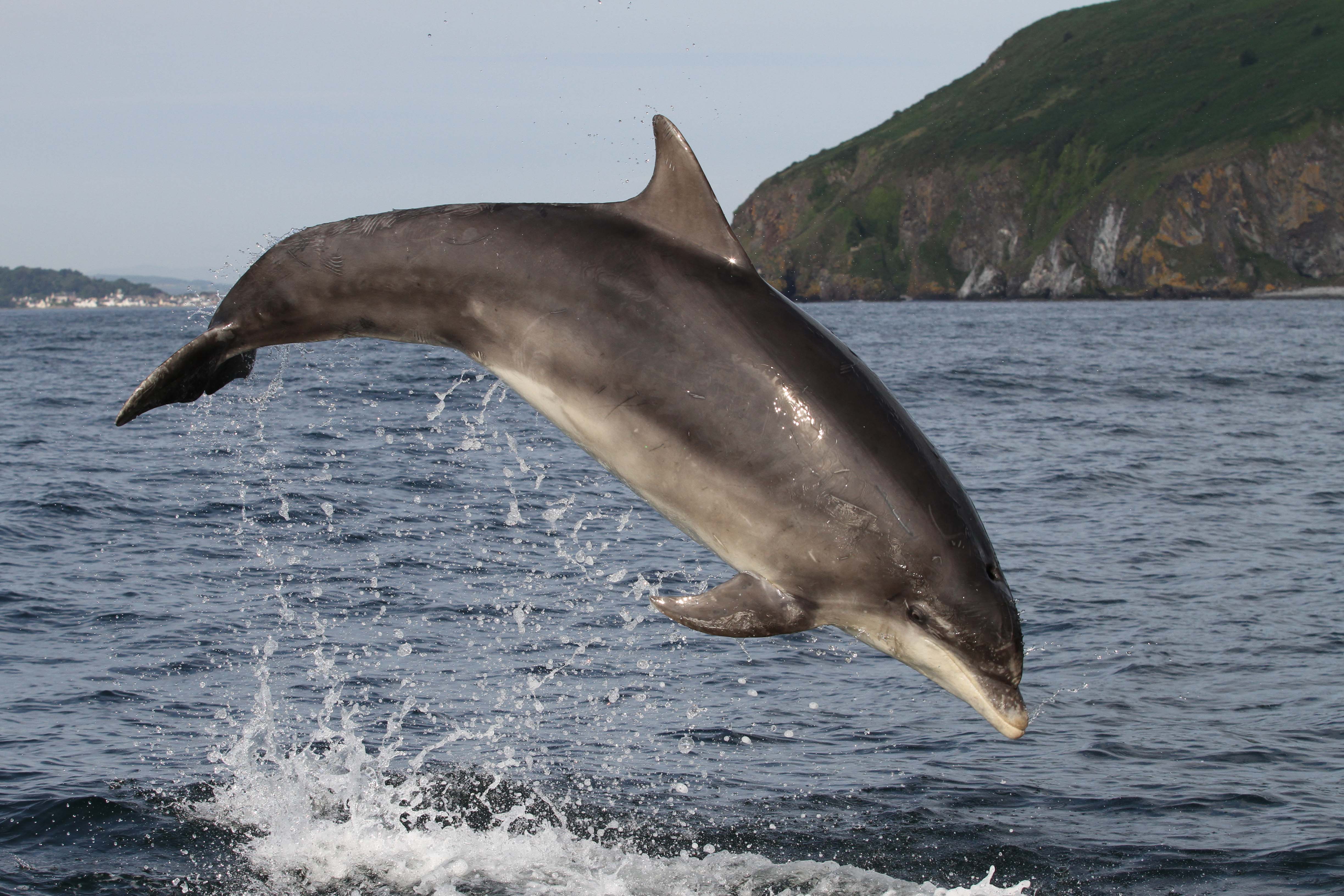
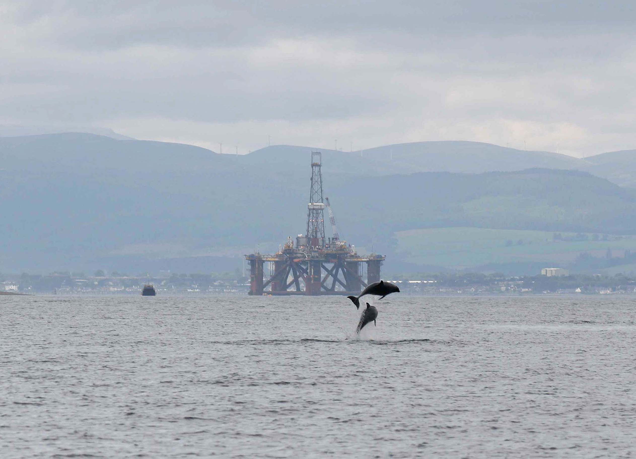
The Moray Firth Special Area of Conservation (SAC), designated in 2005, protects the only resident population of bottlenose dolphins in the North Sea, which is the most northern resident bottlenose dolphin population in the world! In today’s blog, Rona Sinclair from our marine team and Barbara Cheney from the University of Aberdeen dive into the latest monitoring results and research from this important habitat for this population along Scotland’s east coast.
Historically centred around the Moray Firth, there are now estimated to be over 200 bottlenose dolphins that live along the east coast of Scotland. This population of dolphins has been the focus of an intensive research programme, carried out by the University of Aberdeen Lighthouse Field Station in collaboration with the Sea Mammal Research Unit (SMRU) at the University of St Andrews for over 30 years. NatureScot contracts the University of Aberdeen, jointly with SMRU, to make regular status assessments as part of the site condition monitoring programme for the European National Site Network and the Scottish MPA network.
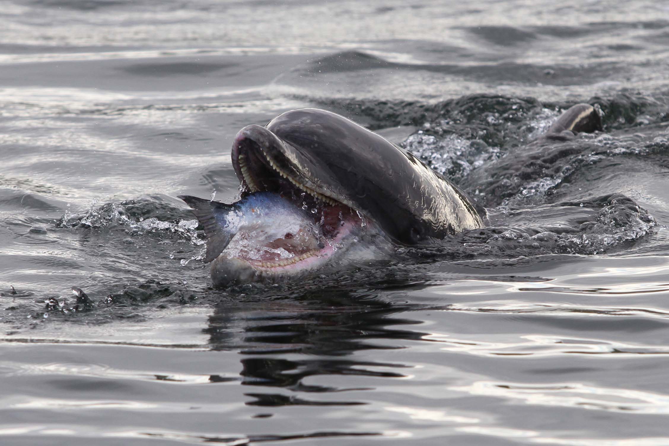
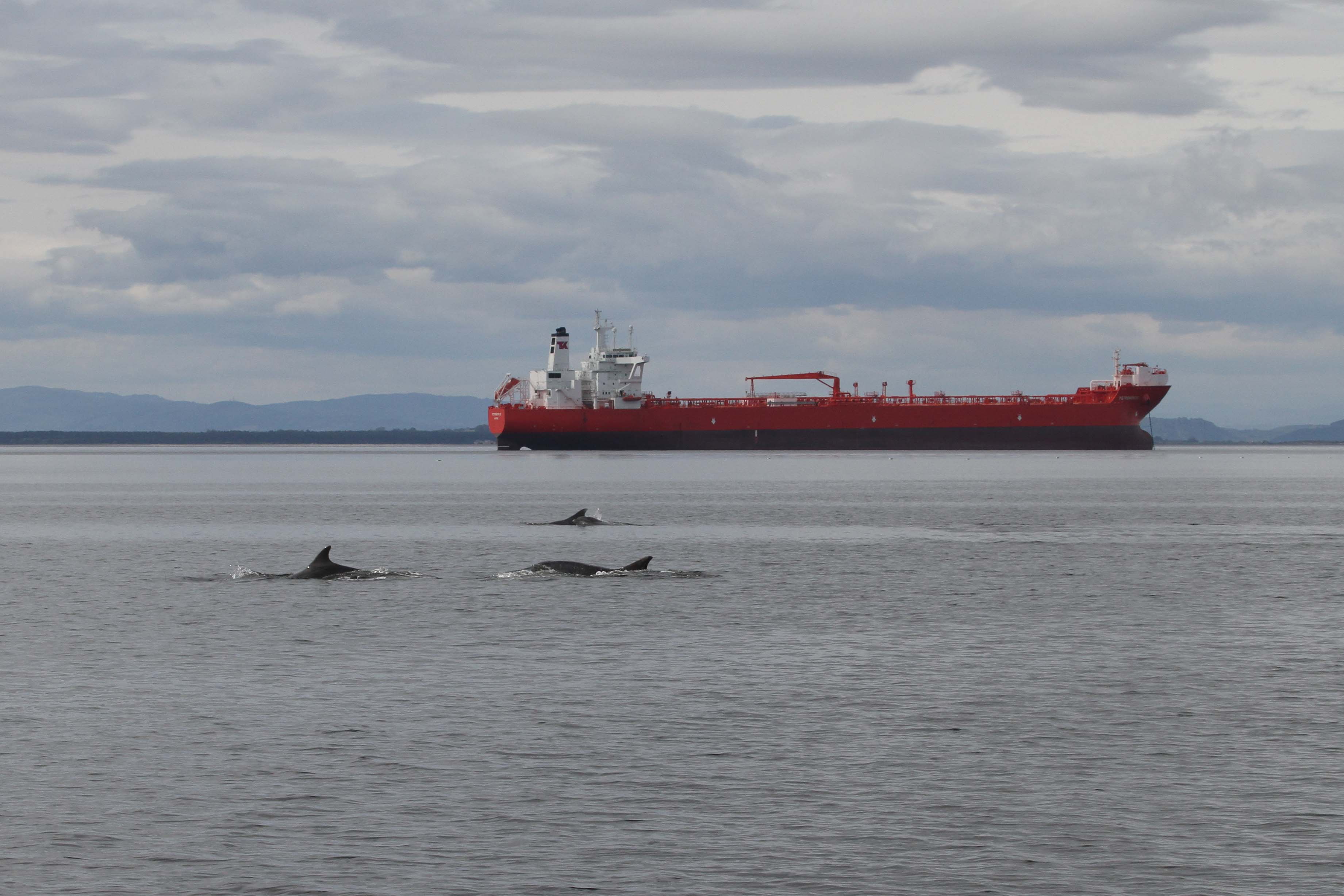
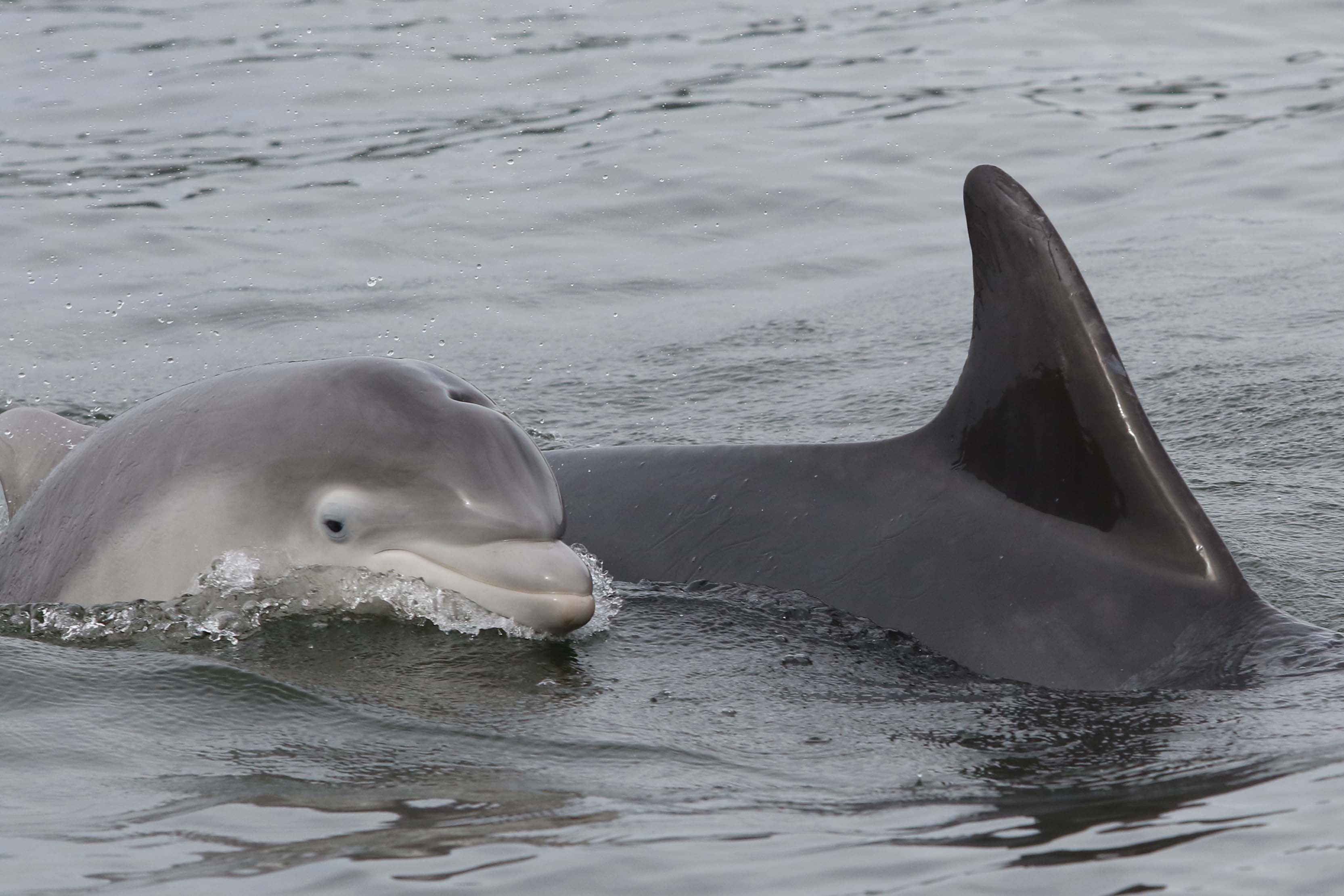
This research and monitoring work is based on the annual collection of photographs of individually recognisable dolphins, identified using nicks and rakes on their dorsal fins. Boat-based surveys are carried out between May and September in both the Moray Firth and the Firth of Tay and adjacent waters. The research in these two locations provides data on abundance, distribution, survival, reproduction, social structure, and body condition. Passive acoustic monitoring of underwater sounds, including dolphin vocalisations and anthropogenic noise, in the inner Moray Firth complements the photo-identification work, providing information on how the dolphins use the SAC and even data on feeding activity.
Since 2014 the long-term monitoring programme in the SAC has been supported through a hugely successful collaboration between industry, universities, nature conservation bodies and government, in the form of the Moray Firth Marine Mammal Monitoring Programme (MMMP). This joint initiative has allowed the continued development of integrated research and an annual monitoring programme. The results have provided a strong evidence base for understanding changes over time in this bottlenose dolphin population and enabled a quantitative assessment of potential impacts for both management and conservation.
The Moray Firth is a busy place and since its designation as an SAC the dolphin population has faced changing pressures in its habitat. This designation provides an additional level of environmental assessment, with the Conservation Objectives seeking to maintain the condition of the bottlenose dolphin population as one of the SAC’s protected features. This designation is also an opportunity for stakeholders to input into decisions being made about activities, has been effective at assessing potential impacts, and has required additional mitigation and monitoring to ensure the site Conservation Objectives are met.
In the early 1990s before the SAC was designated the bottlenose dolphin population in the Moray Firth was thought to be largely contained within the future SAC boundary, and by the time of designation was reported to be in Unfavourable (recovering) condition. This most recent 2024 site condition monitoring report, including new analyses and data collected between 2017 and 2022, shows that the long-term trend (since 2001) in the number of dolphins using the SAC is stable and the use of this protected area continues to be high. However, the short-term trend (over the last 6 years), does show a decline in the number of dolphins using the SAC. At the same time, there has been an increase in the number of dolphins using the Tayside area and adjacent waters. This highlights a need to investigate the potential drivers of this change in habitat use through continued monitoring and further targeted research. Despite this decline in SAC usage, the east coast population continues to increase, with both the SAC and Tayside and adjacent waters being used by more than 50% of the dolphin population in most years.
Results from the latest site condition monitoring report emphasise the need to understand the recent change in use of the SAC. Continued monitoring of both the Moray Firth SAC and East Coast waters is crucial to support future site condition assessments of the Moray Firth SAC and further develop our knowledge of this bottlenose dolphin population. This will ensure a continuity of research and future tracking of trends in abundance, survival and reproduction.
To increase understanding of the use of areas by this population outwith the SAC and Tayside and adjacent waters, the current focussed data collection should be complemented by additional studies. This should include integrating photographs of dolphins from citizen scientists, which have already added to our understanding of the movements of individual dolphins, including the continuing range expansion into northeast England to longer range movements to other parts of the UK and Ireland, and even into European waters. A new programme of work has recently started to improve understanding of the population’s range expansion into NE English waters including quantifying the connectivity of dolphins across its range.
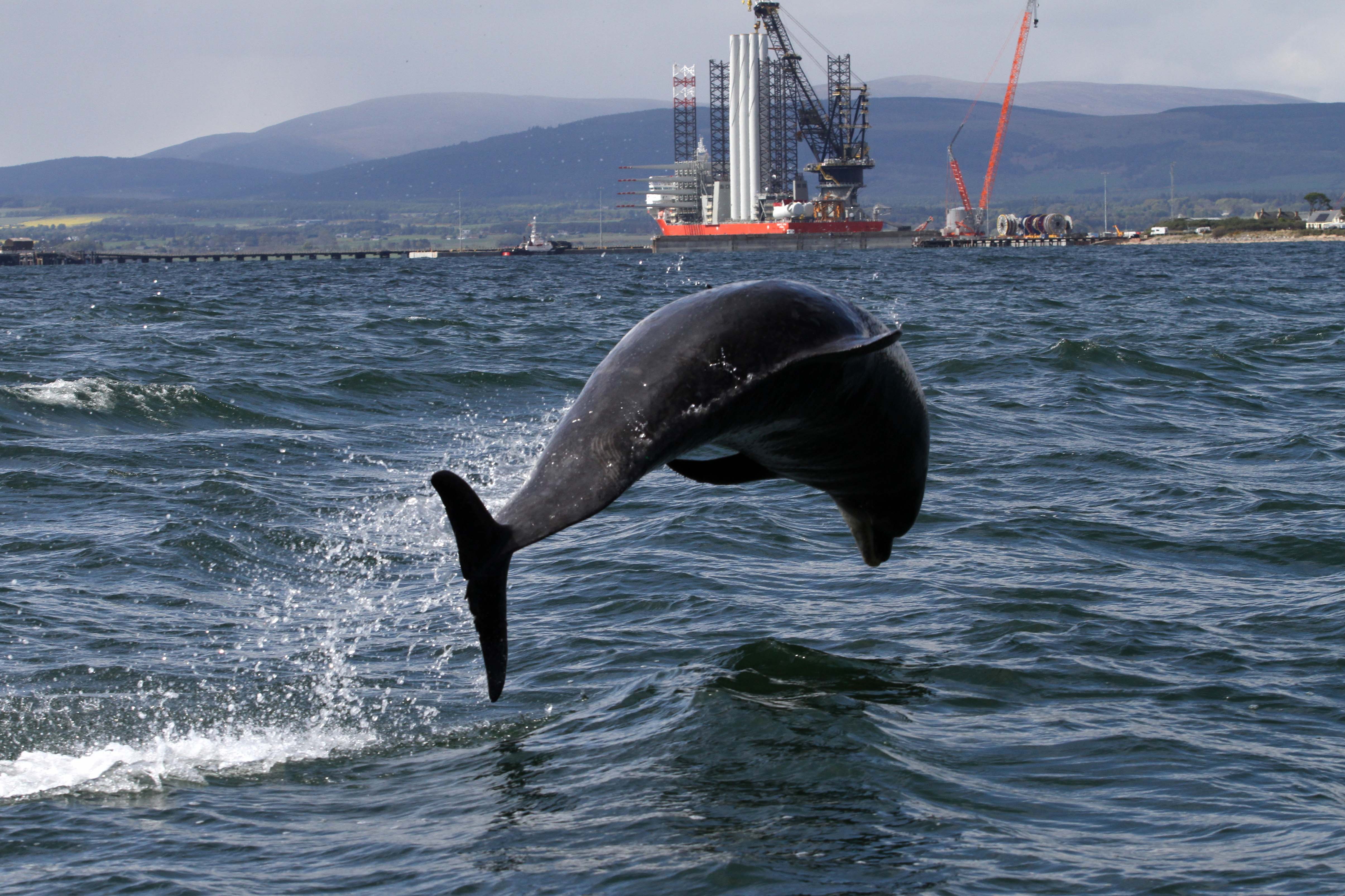
There are also opportunities to investigate whether the change in use of the SAC is due to changing conditions in the Moray Firth habitat or improvements in other areas along the east coast, or both. Ideally future research will focus on ecosystem quality, including stressors and drivers of population change. Surveillance of key habitat features (e.g. prey) and pressures (e.g. vessel activity) could indicate how these are driving changes in dolphins’ habitat use. Vessel traffic within the SAC is expected to increase and ports and harbours are expanding to support offshore energy developments, which present new opportunities to develop our understanding of interactions between bottlenose dolphins and human activity. For example, there is potential for exploiting AIS vessel tracking data and broadband passive acoustic monitoring to evaluate any impacts in key areas of dolphin presence. Also, it is important to explore links between trends in key prey species and observed trends within the bottlenose dolphin population.
Despite the recent decline in the use of the Moray Firth SAC, overall, the news continues to be positive for this small bottlenose dolphin population. Over the longer term the use of the SAC is stable, the use of this protected area is high, and the east coast population is increasing. This has resulted in the current condition status of the Moray Firth SAC being assessed as Favourable (maintained).
In today’s blog, NatureScot’s Ornithology Adviser, Dave Parish gives us an insight into some of the ways farmers are helping to support Scotland’s critically endangered chough.
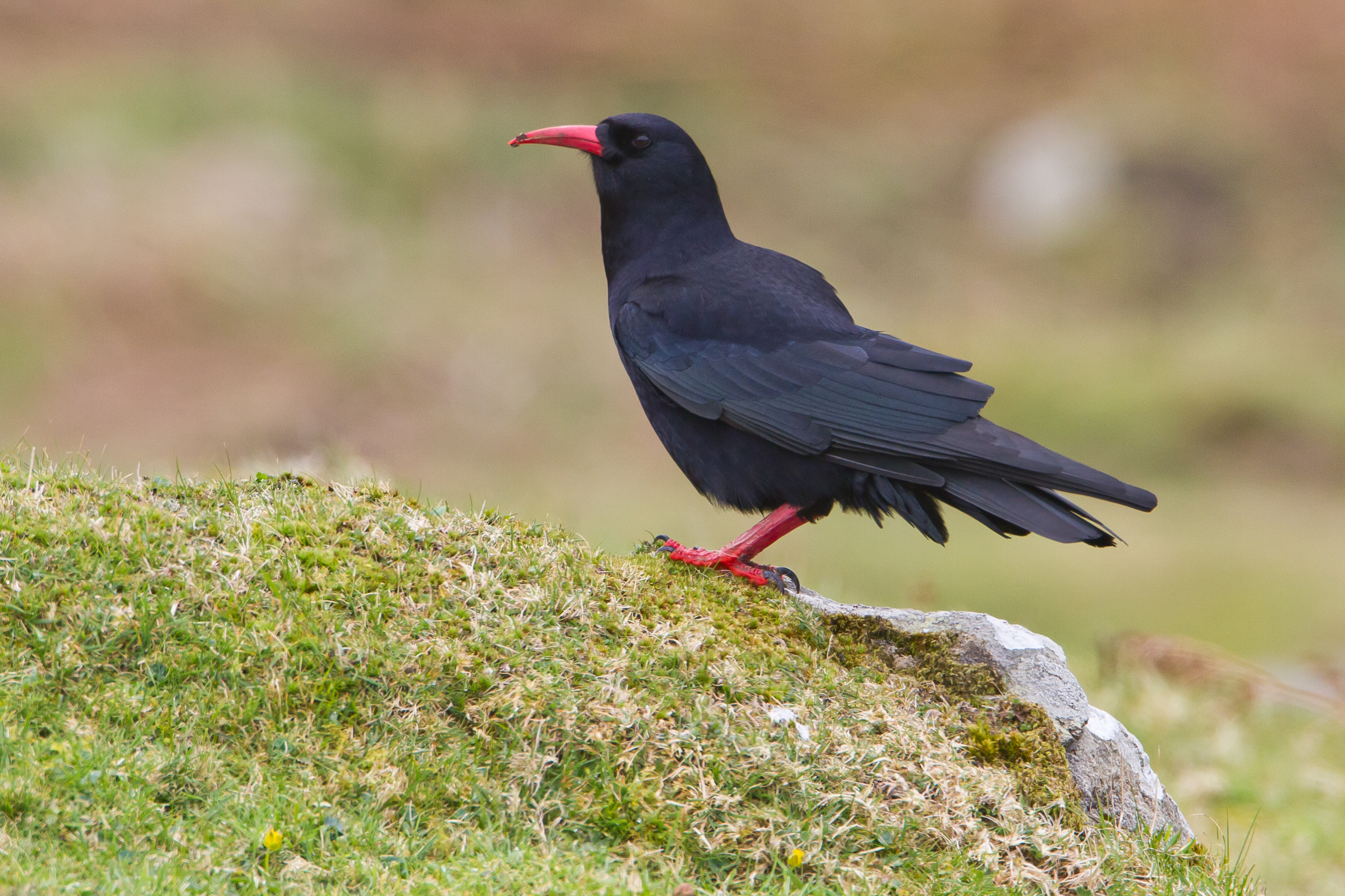
This is an exciting time of year…chough are now laying their eggs at the start of another crucial breeding season. With its striking red bill, the chough is a dapper, medium-sized member of the crow family (hence its proper name, the red-billed chough). The population in Scotland is precarious by any definition with around just 50 pairs left, all confined to the islands of Islay and Colonsay. This means that each breeding season, and each chick successfully raised, is vital to the future of this species.
Choughs usually lay between three and five eggs in a scruffy-looking, large nest made of twigs, often built on top of some kind of large platform. These can be in cracks in cliff faces and the like, or in farm buildings. In some circumstances they will take to nest boxes, but this is not a good idea as the confined space becomes messy with faeces and can cause health problems for the chicks. Farmers in appropriate locations can receive grant funding through the Agri-Environment Climate Scheme to install chough nest shelters, which comprise a large, open nesting platform in the roof space of an appropriate outbuilding. These should give plenty of room for the chicks to grow and move around as they flex their muscles in preparation for flight, and – not to put too fine a point on it – allow them to poo over the edge and so keep the nest relatively clean.
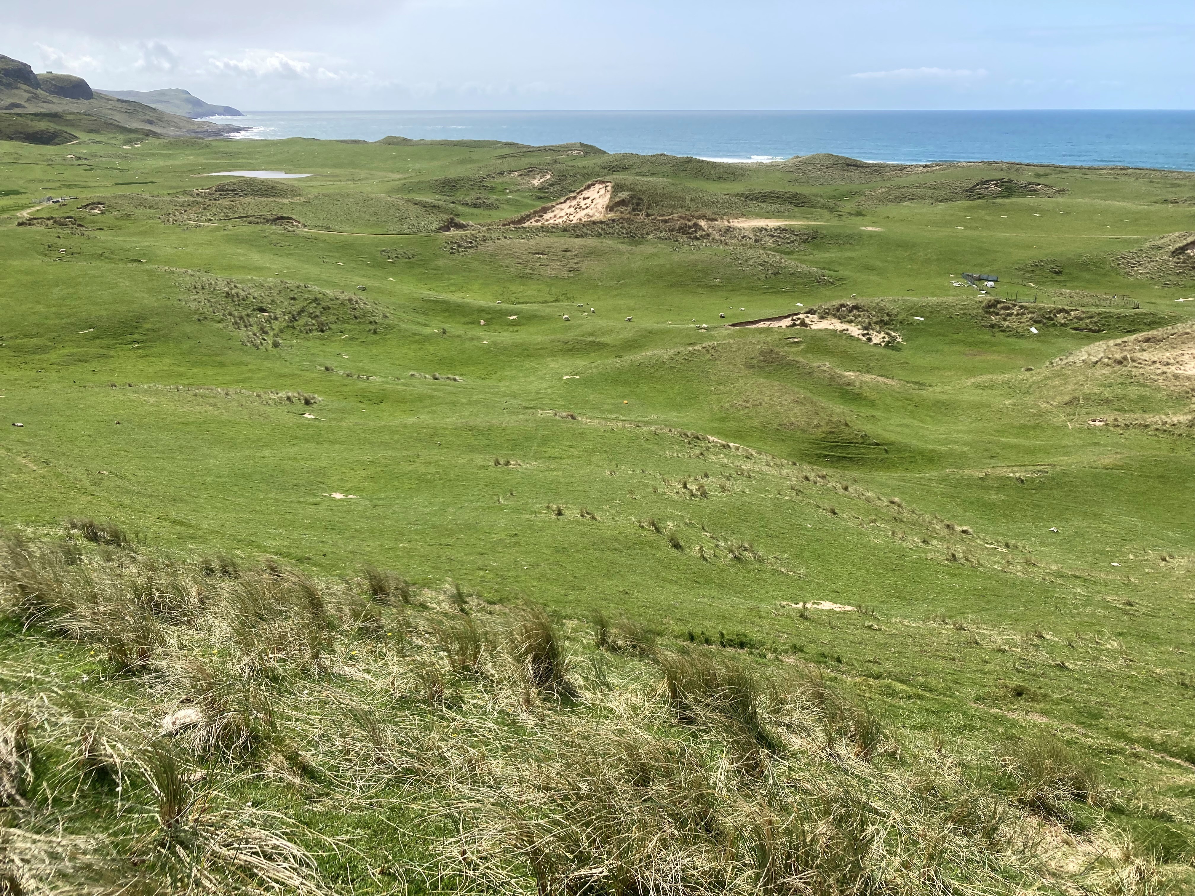
Short, grazed grassland and coastal dune systems are ideal habitat for chough. Kilchoman warren, Islay.
Choughs are dependent upon a relatively low-intensity type of agriculture, where cattle and sheep graze grass fields and the coastal dune systems around the islands for most of the year. This provides the choughs with the preferred short grass in which they search for invertebrates – especially those associated with cow dung. But unfortunately, cow dung isn’t what it used to be. There are fewer cattle on the islands now than in the past, and they are often treated with drugs to tackle potential parasites, drugs which often persist in the dung and deter or kill the beetles and flies that would normally call the dung home, leaving the birds little to eat. This and other agricultural changes mean that young choughs in particular find it hard to find enough food to survive.
Cow dung tends to have fewer beetles and flies on it (chough food) when cattle have been treated with drugs to tackle potential parasites, which can remain in the dung and deter other beasties.
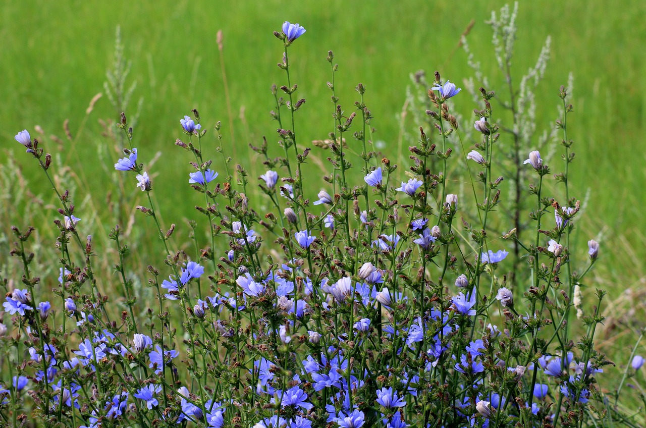
There are ways to help minimise the need for drug treatments, and to check whether livestock need drugs before they are administered. The local vet should be able to advise on this or there are resources online that might help, like Dung Beetles for Farmers. For example, adding chicory and other species into the grass sward at reseeding time, which have anti-parasitic properties and additional fibre, could reduce the need for treatments and help make swards more resilient in the face of changing weather conditions. Similarly, carrying out faecal worm egg counts or simply monitoring body condition closely, can all help identify whether intervention with drugs is needed. There are many other actions that could reduce the reliance on drugs and therefore boost dung-invertebrate numbers (and reduce farm costs), and so provide vital food supplies for young choughs and help change the species’ fortunes.
Adding chicory to the grass sward at re-seeding time could reduce the need for parasite treatment of livestock.
The chough is a protected species – as indeed are all birds during the breeding season – so it is important that they are not disturbed. We are fortunate that choughs in Scotland are very carefully monitored by a group of licenced experts, so in a few months we will know what kind of season it has been and whether the birds have produced lots of chicks. So, keep fingers crossed and watch this space for an update!
Dave Parish is an Ornithology Adviser at NatureScot and specialises in farmland birds, waders and game birds.
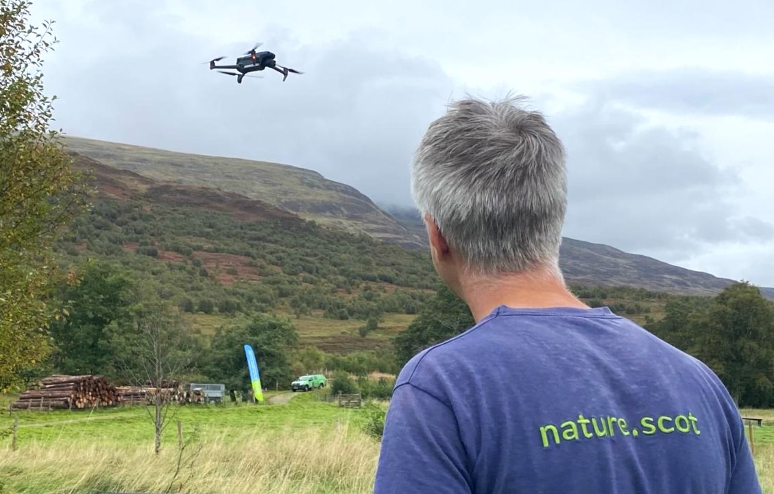
From drones to artificial intelligence (AI), new technologies are changing the face of wildlife management. In today’s blog, our wildlife management officer Nathan Berrie looks at some of the advantages – and limitations – of these new tools for monitoring deer populations.
Deer are an important part of our biodiversity, but in high numbers they can have a negative impact on woodlands, peatlands and other habitats. Sustainable deer management is vital if we are to meet ambitious and necessary targets to restore nature and tackle climate change.
In its report to the Scottish Government in 2020, the independent Deer Working Group highlighted the need to embrace technology to better understand the challenges and opportunities when managing deer. As the urgency around the nature and climate crises has increased, and with it a move towards more conservation management of deer, innovation in the sector has accelerated.
One area where tech is increasingly being developed and deployed is deer counting. Knowing how many deer use an area is important to determine how to manage populations sustainably. Historically, helicopters have been used and they remain our primary method of counting. However, alternatives are being explored to lower carbon emissions, cut costs and increase efficiency.
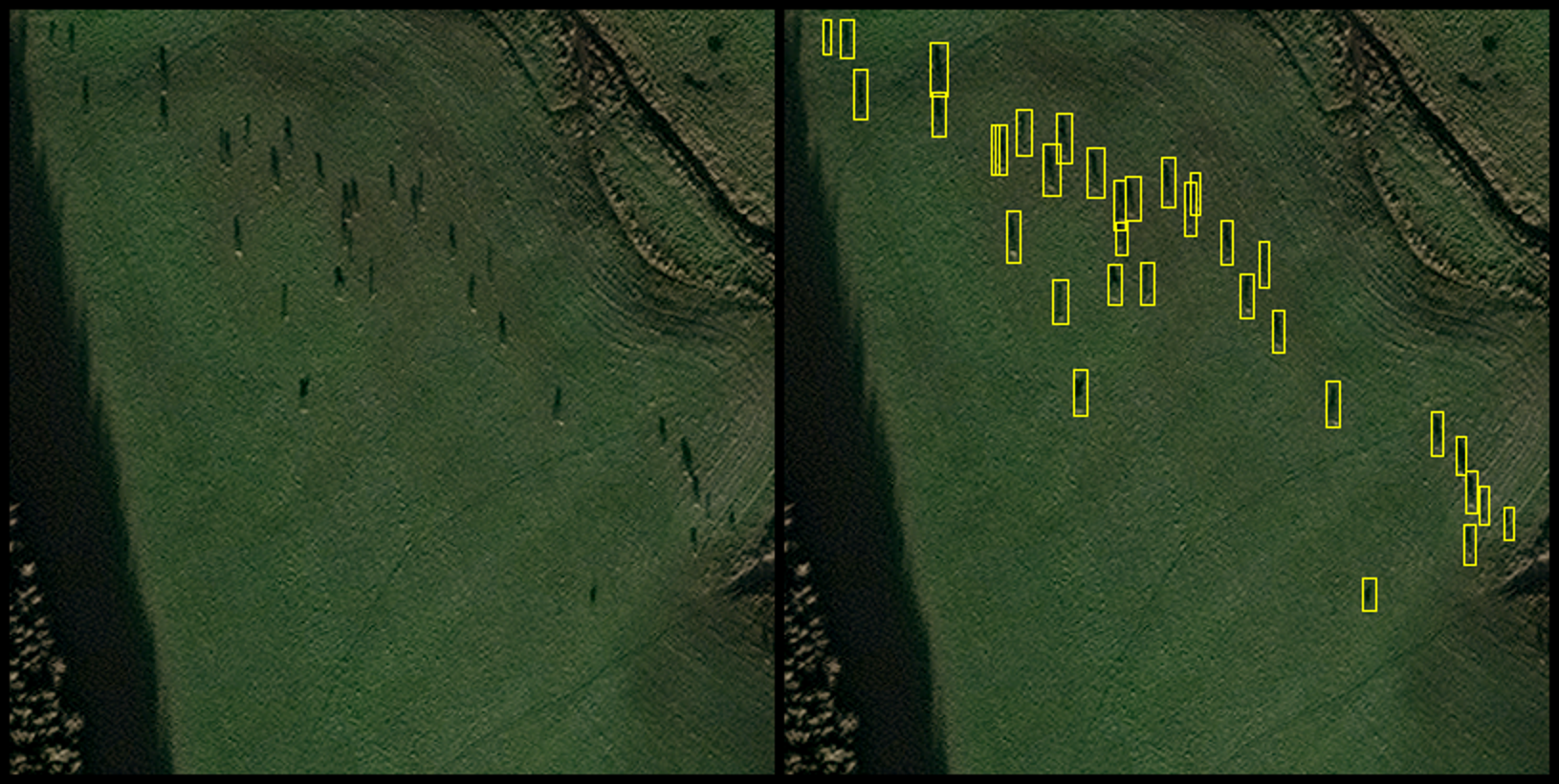
Most notably, thermal drones have offered an alternative method in specific situations. Working with B&H Wildlife Consultancy, NatureScot recently completed a thermal drone count at our Taynish National Nature Reserve. This count offered a valuable insight into deer populations at the reserve, including minimum population during the survey, species classification and population movements. Along with robust habitat impact assessments, this data can help support our decision making on deer management.
Thermal drones do have their limitations though. Legal flight requirements stipulate a maximum flight distance of 500 meters and keeping the drone within line of sight. The need to continually move to the next survey point risks disturbing deer and skewing the results. Alongside battery lifespan, weather conditions and limited ability to classify sex and age, drones can struggle to provide results in many landscape-scale situations.
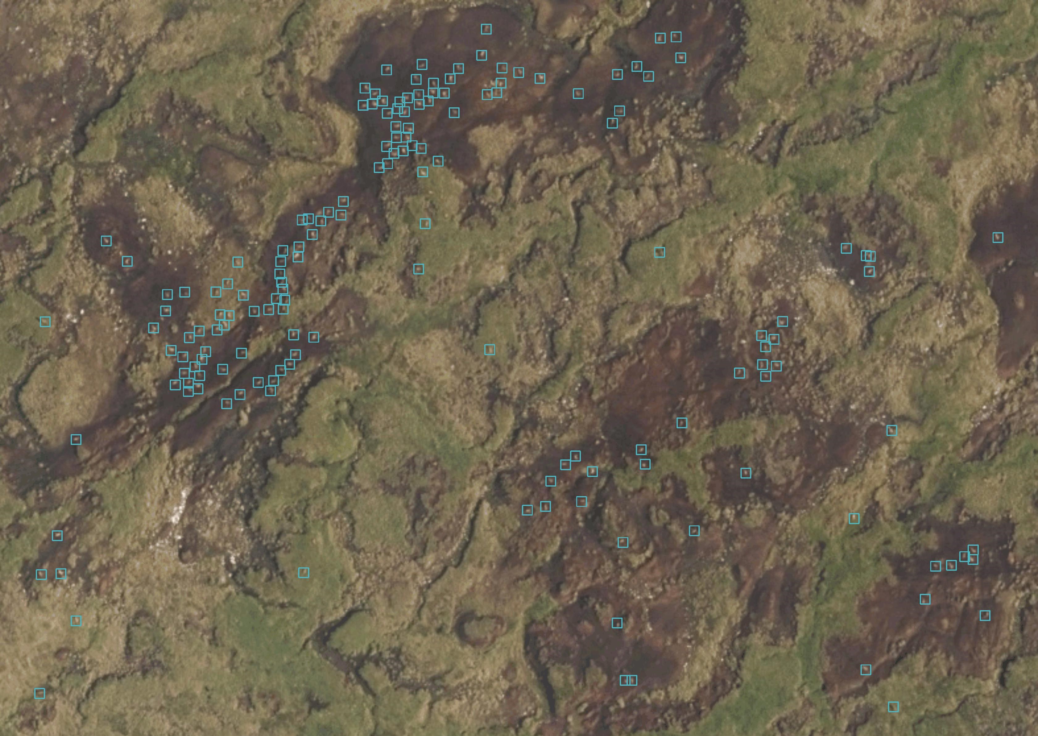
Several other novel approaches may offer solutions. Supported by the Scottish Government’s CivTech programme, NatureScot worked with EOLAS to explore using existing satellites and a newly developed wildlife artificial intelligence (AI) image recognition tool. Although in its infancy, the technology showed promise and has the potential to provide swift and accurate data across a larger area of open land. With further development it could provide real-time and frequently updated population information.
Again, much like drones, the technology has its limitations. Limited image resolution currently makes it challenging to classify sex, age and possibly species of deer. Furthermore, if higher resolution images are developed, there are data storage implications due to the image size. But most of all it is the good old-fashioned Scottish climate that creates the biggest challenge. According to the Met Office, Scotland’s average annual sunshine hours over the whole country are 1,160, meaning that the sun shines just over 25 per cent of the time. Nevertheless, if conditions allow, this technology can be successful. So much so that it is now being used by EOLAS to help conservationists count African elephants.
Another alternative method may help overcome the cloud cover challenge. In phase two of the CivTech project, lightweight manned aircraft that can fly below the cloud cover were trialled. Significantly greener than helicopters, these light aircraft can cover large areas and collect high-resolution images which could be run through the AI software. This technology could allow deer to be classified as stags, hinds, calves and could also be more useful for looking at habitat type and condition—something which current satellites are incapable of.
Whether new or old, each monitoring method has its place depending on management needs. At present, helicopters will be faster and more efficient when faced with numerous priority sites that need counted. And while it can be easy to get excited about a new shiny bit of kit, in truth the conventional dung or foot count may give wildlife managers a better indication of how many deer are on the ground.
There’s no doubt that new technologies are already adding increased flexibility and efficiency for deer managers but looking to the future, it’s likely that a combination of new and traditional methods will be used to get the most accurate outcome.
This article first appeared in issue 69 (Spring 2024) of the Reforesting Scotland Journal.
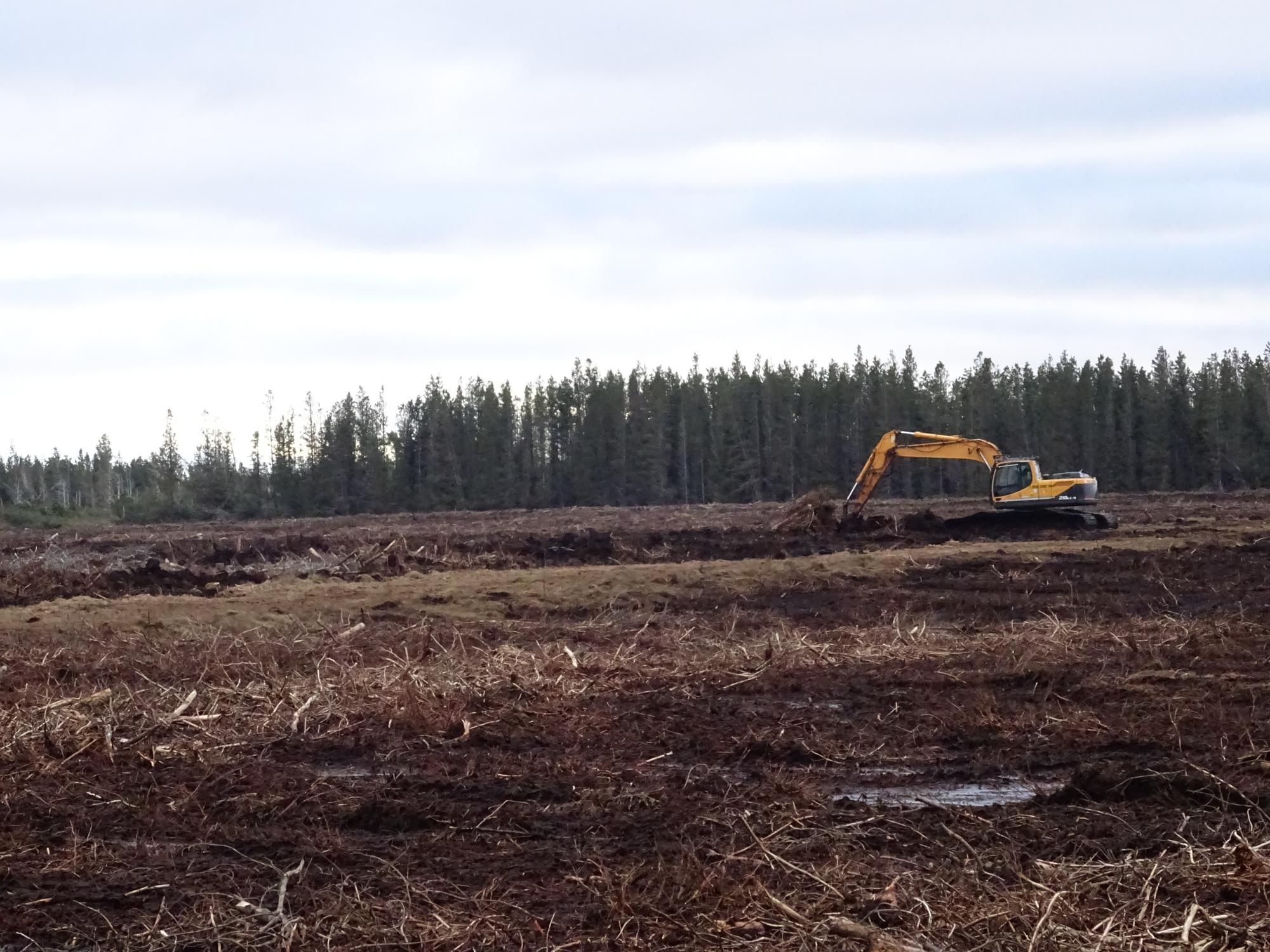
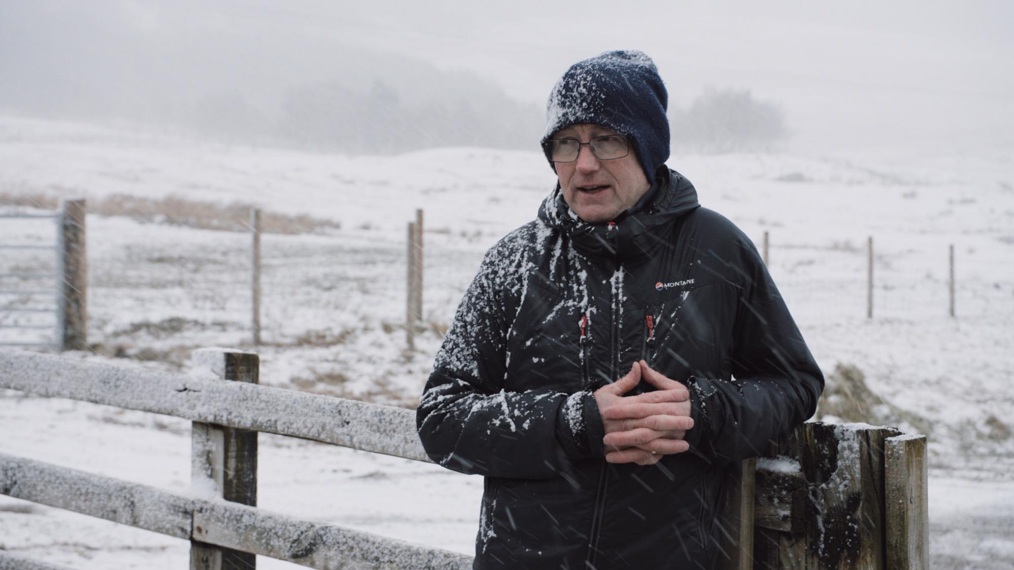
Snow, wind, rain, wind, hail, frost – did I mention wind? The Scottish weather makes creating case study films of some of our peatland restoration projects interesting to say the least – and wind is our worst enemy!
Over the last two winters (when the majority of restoration work happens), our Peatland ACTION team has been working with a film-maker to create a suite of case study films to highlight what’s involved in peatland restoration projects. Most importantly we’ve been talking to the people directly involved in the work – landowners, land agents, contractors, and the Peatland ACTION project officers who help see the projects through from beginning to end. We hope that these films will encourage more people to restore their peatlands.
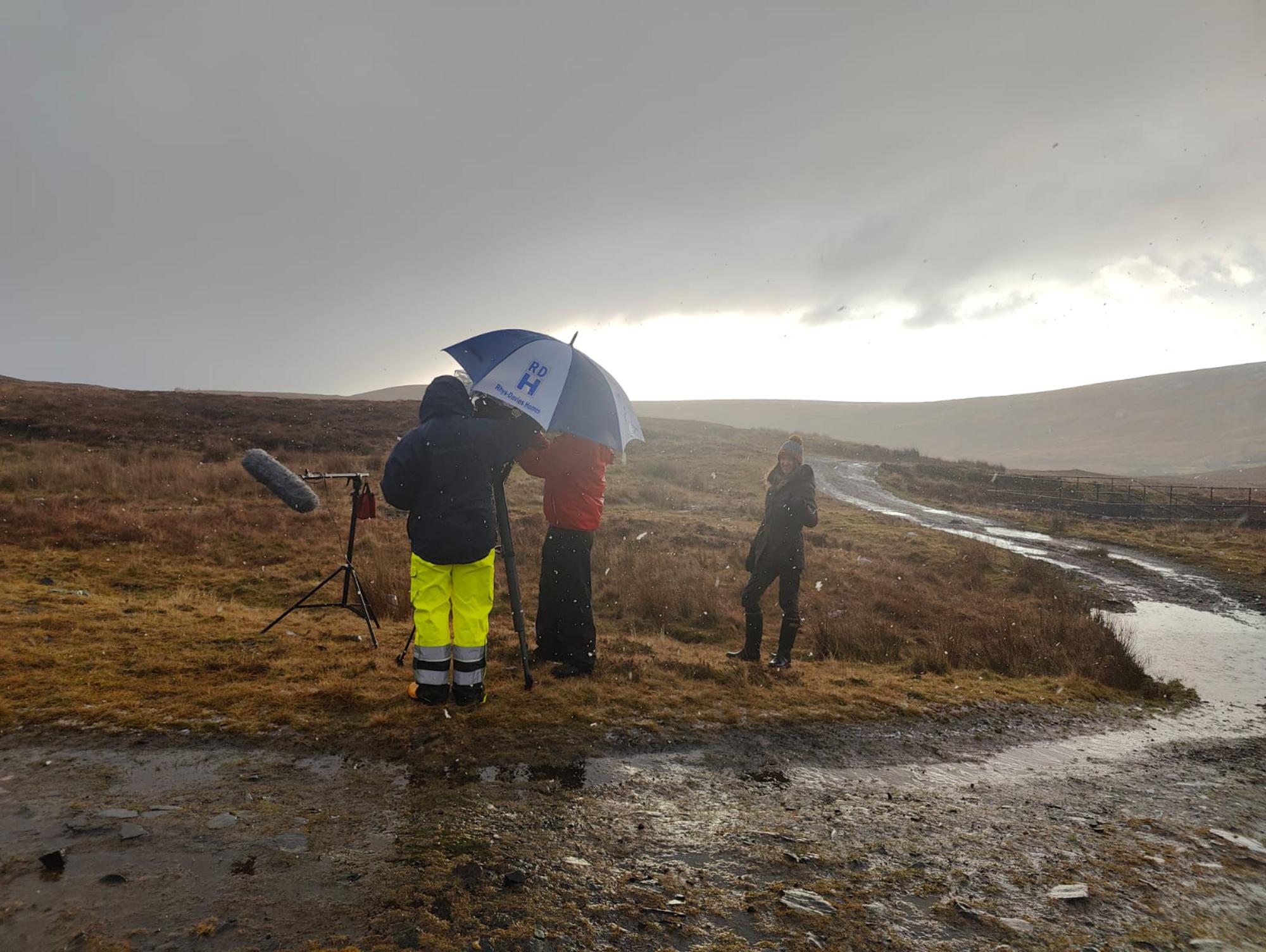
To do this takes a lot of organisation and co-ordination. We need to get several busy people out on site at the same time, often planning filming weeks in advance to ensure everyone can make it. Our film maker Richard is based in Edinburgh, while the sites we want to film, and the people we interview, may live and work hundreds of miles away in the Highlands – so travel and accommodation need to be booked a long way ahead.
This is all fine when the weather plays ball. We all turn up on site, Richard films the interviews, and then he can spend the next couple of days filming the contractors in action, and the restoration work both on the ground and using a drone.
But sadly the weather isn’t always on our side. Our interviewees are a hardy bunch, and have put up with horrendous conditions to allow us to film them talking about why they are doing a project, what the benefits are, and why they want to encourage others to get involved. We are eternally thankful!
But the peatlands themselves are not so accommodating! If the ground is frozen, it’s really difficult for the contractors to carry out the work, as the peat crumbles and breaks as they try to move it to create dams or reprofile hags and gullies. Heavy snow means they can’t see the ground to know where to work. Too much rain and the camera could get damaged if it can’t be kept dry.
And then there’s the wind. A key part of the films is the drone footage which gives a birds-eye view of the work going on, so that we can get the best view of the diggers in action, and see what has been done at scale. If it’s too windy, Richard can’t use the drone and may have to wait days or weeks for a weather window, needing a possible further 300-mile round trip to capture the footage. High winds can also make interviews tricky, as the noise as it hits the microphone can drown out the voices.
We are extremely proud of all the films we have made so far, and we hope they will inspire landowners, land managers and contractors to get involved in peatland restoration. You can watch them all on our Peatland ACTION YouTube playlist. However we thought readers might also like a peek behind the scenes to see what filming can really be like. So we asked Richard to create an ‘out-takes’ film to give viewers a taste of a Scottish bog in winter. You’ll be able to see us filming in snow, wind and rain, and understand why there are some times we just can’t film at all. We are so grateful to all our interviewees who braved some horrible weather to allow us to film them – they are true film stars!
Our thanks to Richard Nicholls of Swift Films, and all the fantastic interviewees who braved the weather to make our films possible.
If you’d like to know more about peatland restoration in Scotland, see our Peatland Action web pages.
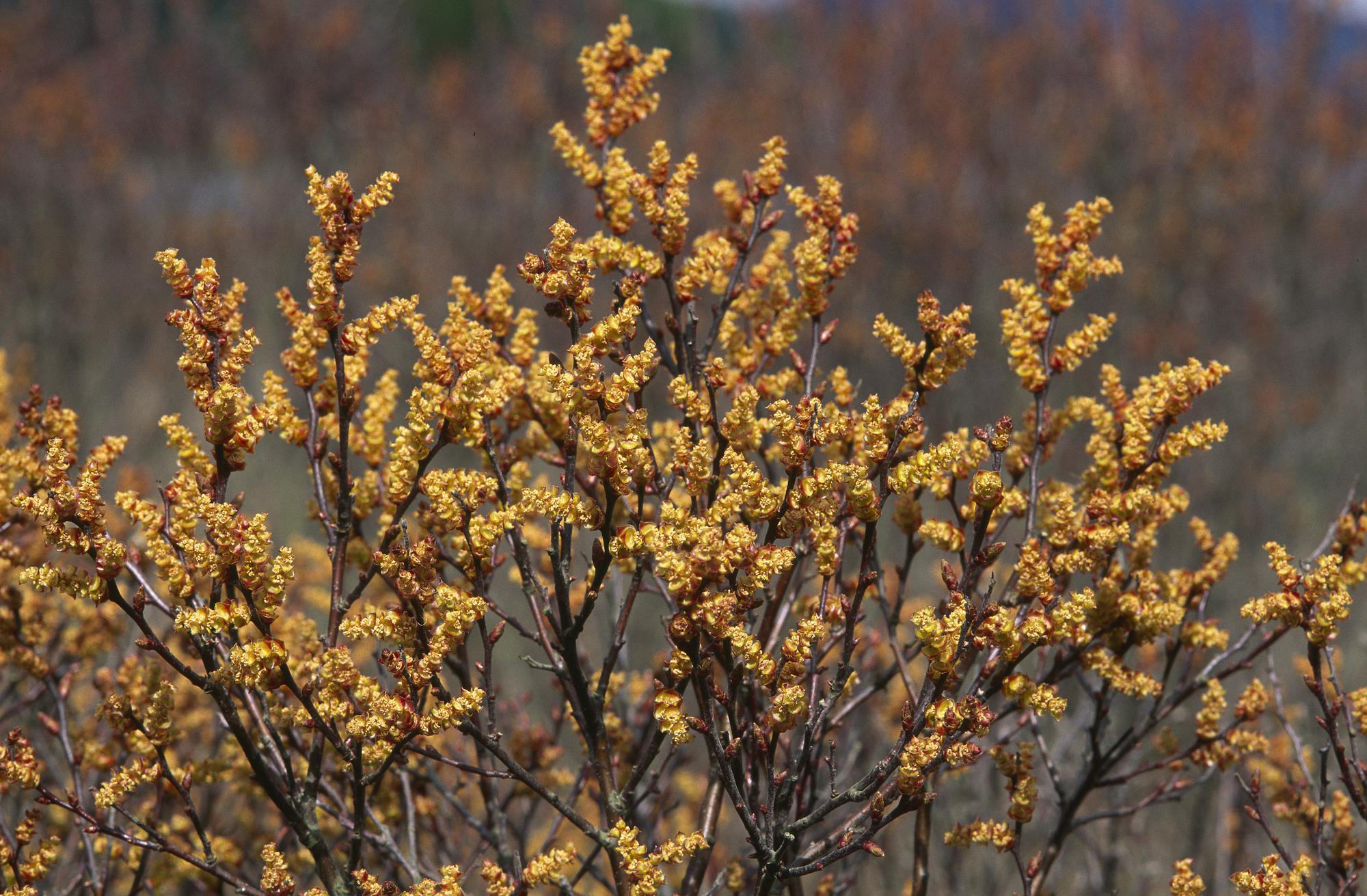
Over the centuries, the plants that live on bogs have been ascribed a whole host of special properties – some magical, some practical. Earlier people living on the margins of peatlands managed to eke out a living by using their local bog as pharmacy, builders’ merchants and grocers.
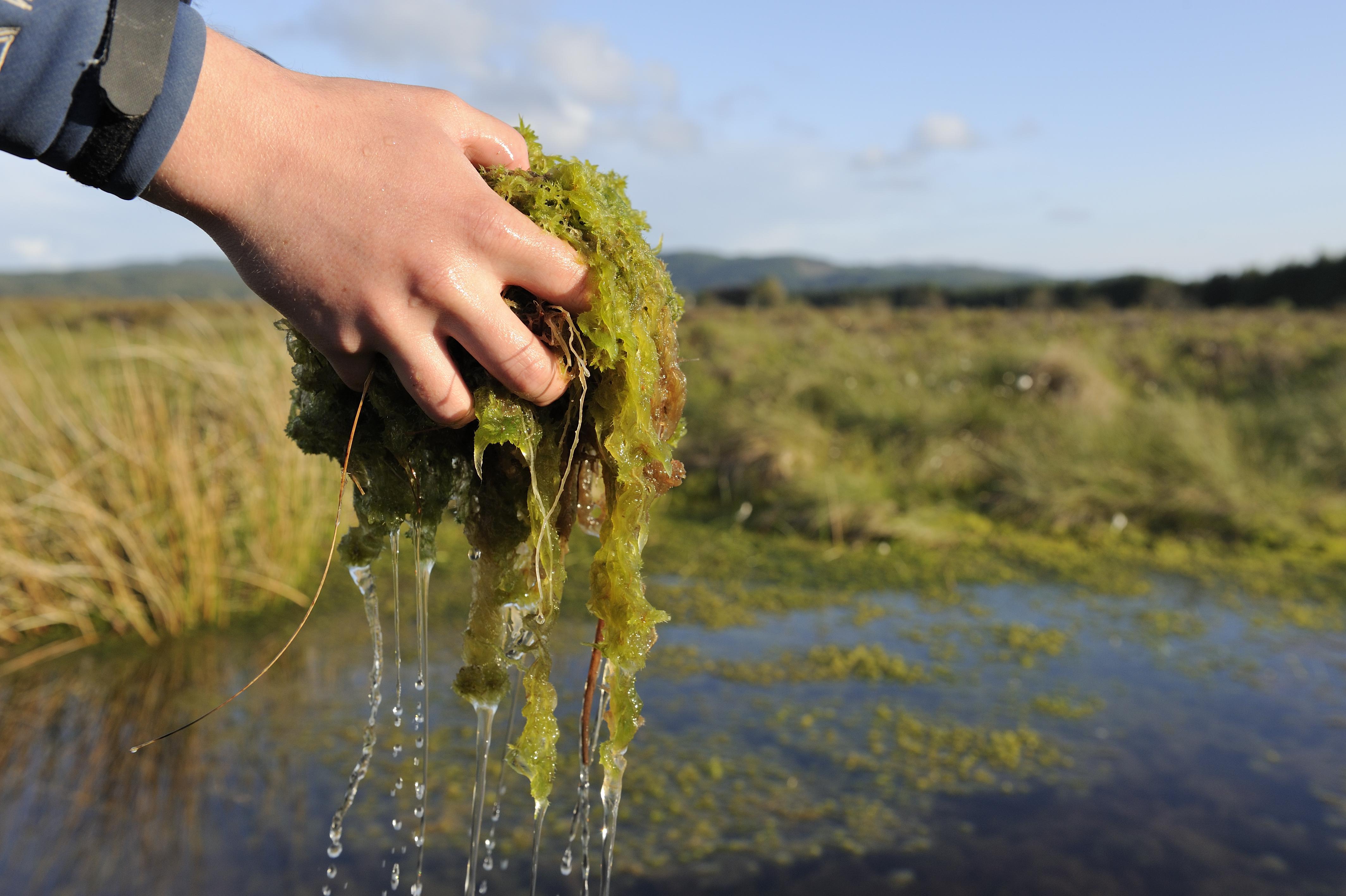
Spagnum moss
Many people know that sphagnum moss was used as a wound dressing during the First World War. Even as late as the Second World War, girl guides were sent out to collect the moss for use in hospitals. The moss contains penicillin – an effective antibiotic. This was no cottage industry either. It was estimated that 500,000kg was processed every month, when it was cleaned, dried and put into thin muslin bags that could expand as the sphagnum absorbed the fluids from the wounds. Sphagnum moss has also been used as toilet paper and nappies because of its amazing ability to absorb liquids. And of course it’s the building block of peatlands for that very reason.
Sundews were ascribed much greater powers. The ‘dew’, the sticky globules on the leaves that the plant uses to catch insects, never evaporates in the sun. From this, people concluded that if you put the dew on your skin it would prevent you from aging, or at the very least cure your warts and freckles. Sadly, unlike sphagnum moss’s properties, these claims have not yet been found to have any basis in fact! More prosaically, it was used to make a yellow dye for wool, and more recently provided an ingredient for medicines for respiratory disorders.
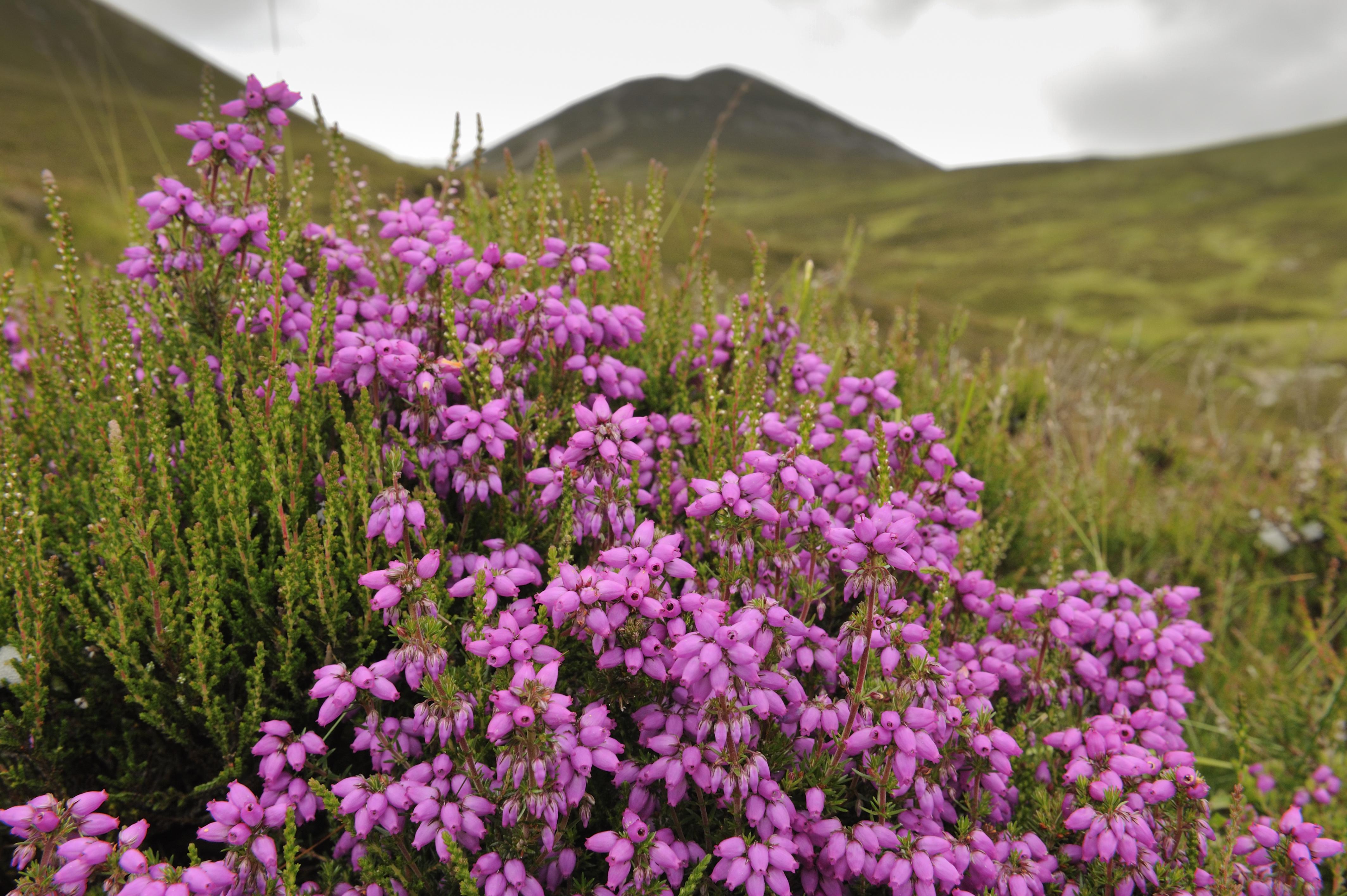
Heather (sometimes known as ling) had a host of uses. The word ling comes from the Anglo-Saxon ‘lig’, meaning ‘fire’. But besides its widespread use as a fuel, ling was made into thatch, bedding, floor mats, insulation, fences, rope, ale, tea, baskets, medicines and brushes!
Bog myrtle was used as a midge repellent and was mixed into heather beds to keep parasites at bay – as well as keeping the bedding sweet smelling. Even today, it is used as an ingredient in commercial midge repellents.
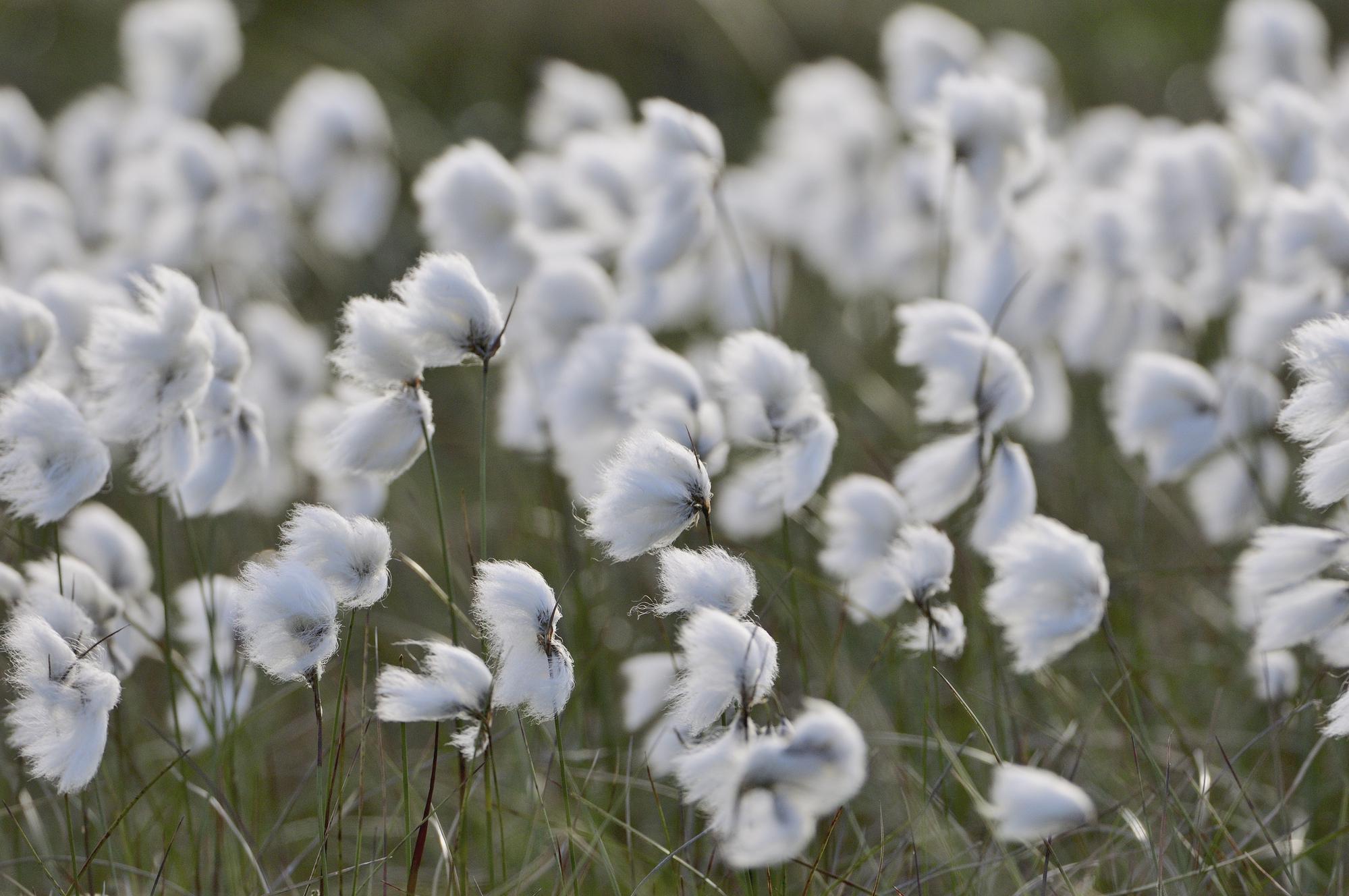
The fluffy white seed heads of cotton grass carpet many peatlands in late spring and summer. While the fibres are too short to actually use as cotton, they were traditionally used to make candle wicks, stuffing pillows and even making wound dressings.
Nowadays we don’t need to look to these peatland plants to support our everyday living. However, just like the flora of the tropical rainforests, we still have a lot to discover about the possible uses of these fascinating plants, so we need to ensure they remain as a valuable resource for the future. And while we don’t rely on them these days, there are many kinds of wildlife for whom peatlands are vital to their existence, providing a home, food, shelter and a place to breed.
If you’d like to know more about peatland restoration in Scotland, see our Peatland Action web pages.
Peatland ACTION recently released a new case study film about an impressive project in the Highlands that has so far carried out peatland restoration on an area almost a third the size of Inverness.
Strathvaich Estate lies high in the hills between Inverness and Ullapool, and began its peatland restoration journey in 2015. Six phases of work later, over 900 hectares of peatland have so far been put on the road to recovery, with plans to keep going with further restoration until all the most badly damaged peatland is restored. The estate’s owner, Patrick Creasey, estimates there might be as much as three to four times as big an area as they have already tackled still to restore – and he is committed to doing just that.
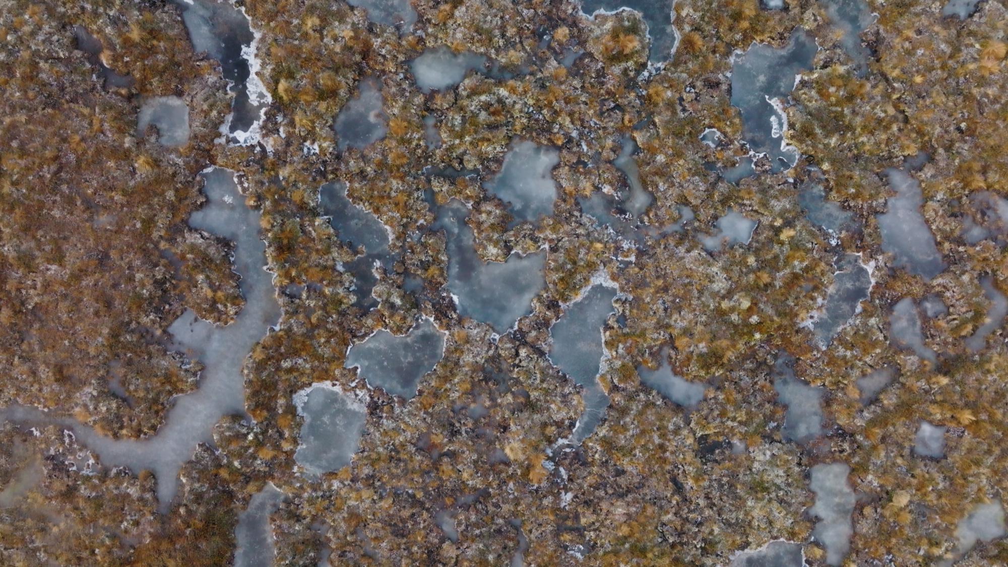
The film explains how the estate works closely with Peatland ACTION through its land agents to plan, develop and deliver the restoration work. It’s a complex site and a wide range of restoration techniques are being used to tackle the damaged areas of peat, including gully and hag reprofiling, drain damming, bunding and timber dams. These different techniques help to stop the water draining away from the peatland too quickly, raising the water table and helping the special mosses that need this wet environment to re-cover the bare peat areas.
What this means is that the hills hold onto their water for longer, helping to prevent flash flooding downstream after heavy rain. The biodiversity also improves, as the invertebrates thrive in the new vegetation, and the birds and other animals that rely on them for food benefit in turn.
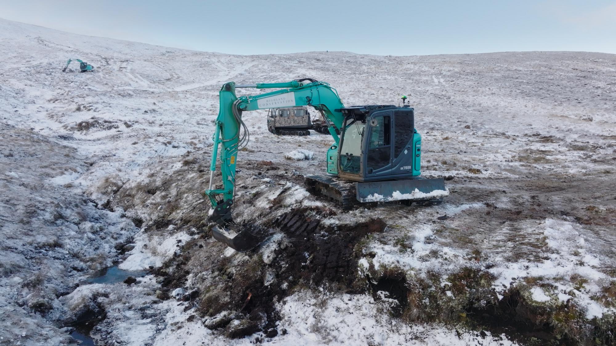
But peatland restoration on remote, high altitude sites like this can be challenging. A lot of restoration work has to take place in the winter, to avoid disturbing breeding birds. That means contractors have to work during short, winter days, dealing with freezing conditions, rain, wind and snow. When the ground is frozen, it can hamper restoration techniques like reprofiling and revegetating, while constant, heavy rain can make navigating across the sodden peat extremely difficult. Contractors need to be skilled and experienced to get it right.
However for those interested in developing the skills, peatland restoration work offers new, green jobs that can benefit the rural economy and allow people to stay close to home for work. For example, Highland Conservation, which carried out the work at Strathvaich, started out with three or four operators and now has 12.
In the days before television or even electricity, our ancestors were very fond of dubh-fhaclan or riddles, and here is one such rhyming riddle with a nature theme:
Chì mi thugam air a’ bheinn,
Fear beag ’s beum na shròin,
Dà fhiacail fhada na chìr
Is cirb de bhlòigh na thòin.
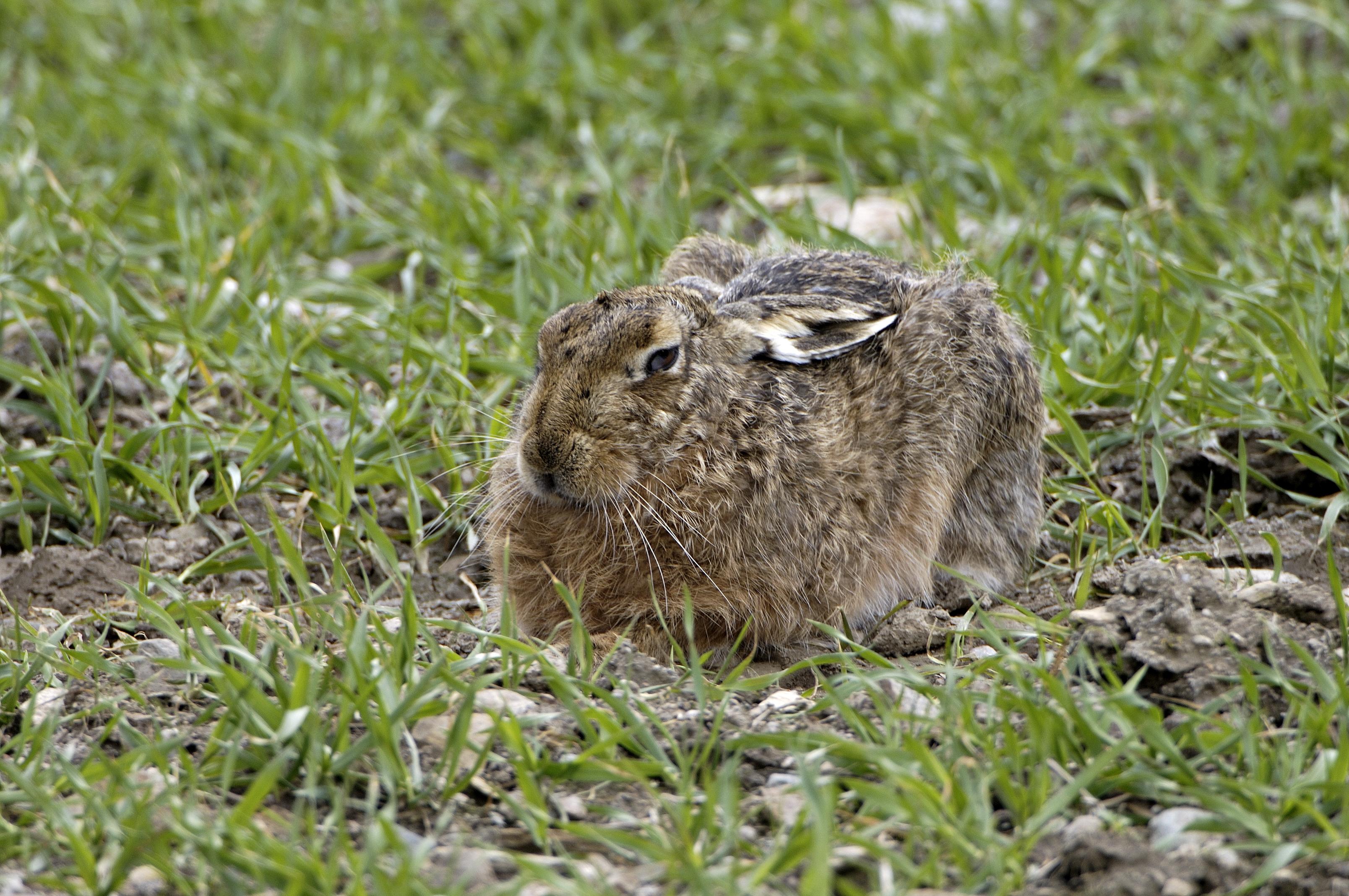
‘I can see coming towards me on the mountain, a wee man with a split in his nose, two long teeth in his jaw and a ragged bit of a tail behind.’ The task of the audience in the taigh-cèilidh would have been to work out the subject of the riddle. It is, of course, the hare – a native mammal which is the subject of a considerable body of folklore in the world of the Gael.
The hare is generally referred to by one of two words in Gaelic, depending on dialect. The first is geàrr which is commonly heard in the traditional simile cho luath ri geàrr ‘as fast as a hare’. The word geàrr (pronounced GYAAR) literally means ‘short’ and arises from a reduction of the phrase geàrr-fhiadh, literally ‘short deer’. The inclusion of the word fiadh here is instructive because it is the root of fiadhaich ‘wild’ and other derivatives such as ath-fhiadhachadh ‘rewilding’, and both the fiadh and geàrr-fhiadh are considered in Gaelic folklore to be a link between the human world and wild nature. Through cruth-atharrachadh ‘shapeshifting’, a human can take on the form of a red deer or a hare. Outside the seal-people of the maritime west, the only other mammal that commonly permits folkloric shapeshifting is the cat and it might not be entirely coincidental that we call the wildcat an cat-fiadhaich. In all these examples, it is most commonly women, rather than men, that undergo such a transformation.
In one of many folkloric examples of hare-human transmogrification, a woman is said to have lived in a bothy near Baile a’ Chlaidh (Ballachly ‘the township of the cemetery’) in the parish of Latheron in Caithness. Her nickname was Am Fitheach ‘the raven’ (another animal with supernatural qualities); that name had arisen from the circumstance of a woman from Reay going to visit the wise woman to seek advice. However, when reaching her destination, rather than finding a woman, the visitor came upon a raven that was raking the grass with heather, presumably in an attempt to concoct a magic spell. The local woman had the reputation of being a witch and was blamed for the milking cows going dry. People had observed, not a raven but a hare, among the cows, and they suspected it of witchcraft – but neither they nor their dogs could catch the offending animal which would take off at speed towards the cemetery.
With stocks of butter and cheese running low, one man eventually set a snare, fixed to the ground with a peg of rowan wood, knowing that the rowan defends against witchcraft. A hare was trapped in the snare but when the man reached it, she had transformed into a woman – the local witch – confirmed as the source of the bad magic. She eventually left Caithness but the man who had trapped her suffered ill fortune and reputedly came to a sorry end in a drowning accident in the Thurso River. A little to the south of her home, beyond Stemster Hill – and I cannot confirm if the toponym bears any relation to her – is Cnoc na Gearra ‘the hill of the hare’. It might also be significant that the nearest hill to Ballachly is An SìtheanMòr (Sidhean Mòr OS) ‘the great fairy hill’ – a place where the supernatural might be expected.
While the Witch of Ballachly reputedly survived, many tales inform us that the only way of dealing with such a supernatural being would be to shoot her, while she was in the form of a hare, with a silver bullet – and several ‘witches’ were reputed to have been dispatched in such a manner. Many tales exist of a hare being injured in a nightly confrontation, only for local people to find that in the morning a local woman bears an identical injury. This common belief in the shapeshifting hare may be responsible for the animal apparently being rarely consumed as a food item in the Gàidhealtachd.
Geàrr was clearly used in the old Caithness Gaelic dialect for ‘hare’. Sìthean na Gearra ‘the conical “fairy” hill of the hare’ lies in the heart of the Caithness Flow Country while Creag nan Geàrr ‘the rocky hill of the hares’ is to be found among the shapely Braemore hills in the south-east of the county on the border with Sutherland. However, in this instance the modern Ordnance Survey maps leave us a confusing picture, as an almost adjacent summit is given as Creag nam Maigheach, demonstrating usage of an alternative word for ‘hare’ in the same locality. Maigheach (pronounced MY-uch) – derives from magh ‘a plain’ – thus the hare is the ‘one that belongs to the plain’ (presumably referring originally to the Brown hare). It can also occur dialectally as moigheach and, interestingly, given the folkloric connections and their etymological origins, both geàrr and maigheach/moigheach are grammatically feminine. However, the OS Name Book tells us that the original form of Creag nam Maigheach was actually Creag nam Muthach. Although the OS maintains that they are alternate forms for ‘rock of the hares’, Dwelly’s dictionary tells us that muthach means ‘herdsman’ not ‘hare’.
To the west of this area, the word used in Dùthaich MhicAoidh, the Mackay Country of North Sutherland, is also geàrr, and Roy Wentworth’s dictionary of Gairloch Gaelic tells us that the local term there is geàrr, although moigheach is understood, and geàrr is given by Dieckhoff in his vocabulary based on the Glengarry dialect. However, Perthshire man, Robert Armstrong, in his 1825 dictionary, lists only maigheach, moigheach and the full compound noun geàrr-fhiadh.
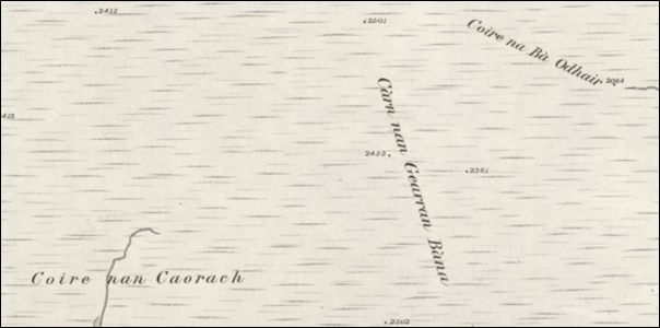
In place names, there is potential for confusion between places named in geàrr for hares and those named in gearran for geldings or Highland ponies, with gearran being the ‘official’ genitive plural form of both, despite the form nan geàrr ‘of the hares’ being found in some toponyms. (As an aside, the English word garron ‘Highland pony’ comes from Gaelic gearran, meaning ‘one that has been castrated’). In their Name Books, the Ordnance Survey tell us that most gearran names such as Meall nan Gearran and Coire nan Gearran between Glengarry and Glenmoriston, and Cruach nan Gearran near Loch Fyne in Argyll, refer to horses. On the other hand, Càrn nan Gearran Bàna on the watershed between Glens Strathfarrar and Orrin means ‘the hill of the white hares’. There are, in addition, places named with the element maigheach in the genitive plural. I know of three hills called Meall nam Maigheach ‘the rounded hill of the hares’ – two are in Perthshire close to Glen Lyon and another lies at the northern end of Ardgour.
Càrn nan Gearran Bàna ‘the hill of the white (mountain) hares’ lies to the north of Glen Strathfarrar, west of Inverness. The altitudes are in feet.Reproduced with the permission of the National Library of Scotland
The animal was used traditionally in a number of medicinal treatments. The gall of the hare was used to treat eye problems, the blood was applied to skin blemishes and the brain was eaten to relieve severe headaches. A mixture of hare blood and skin was used to treat urine retention and bladder stones.
Hares also appear in a number of sayings and proverbs. For example: Cho luath ʼs gu bheil a’ gheàrr, beirear oirre ‘however swift the hare is, she can be caught’. And Is deacair geàrr a chur às an tom anns nach bi i ‘it is difficult to chase a hare from a tuft where she is not’. It was believed that a hare escaping from the final patch of grain to be cut was a lucky omen, whereas encountering a hare at the start of a long journey was a sign of bad luck. The Welsh polymath Edward Lhuyd noted that in the Highlands of Scotland meeting with a hare on high ground was reckoned to bring about misfortune.
The last presumably concerns the Mountain hare (Lepus timidus) which in Gaelic is the Geàrr-bhàn or Maigheach-bhàn ‘fair/white hare’ (reflecting its winter coloration) although bàn can be replaced by geal ‘snow-white’ or monadh ‘upland’ i.e. maigheach-mhonaidh in both compound names. In most instances of Gaelic cultural reference, the lowland Brown hare (Lepus europaeus) is not differentiated from the mountain species, as they share the same generic. However, we can specify the Brown hare by using the Gaelic colour descriptor donn ‘brown’ i.e. Maigheach-dhonn or Geàrr-dhonn.
The young hare – a ‘leveret’ in English – is known in Gaelic as a cuilean-maighich, isean-gearra, piseag-ghearraidh or gearrag, and the ‘form’ or nest is a cuach-gearra. Cuach means a hollow shaped somewhat like a bird’s nest (hares do not burrow but make a grassy nest) and is the origin of the Scots quaich, as it also means a shallow drinking vessel. As in other cultures, there was an ancient belief that a harelip was caused by an expectant mother’s exposure to a hare. Two terms for such a condition are milleadh-maighich and gearradh-maighich, both named for the hare.
Two other instances of the hare in Gaelic culture are the simile cho craicte ri geàrr as t-earrach ‘as daft as a hare in Spring’ which may have been influenced by the English saying ‘as mad as a March hare’ – reflecting on the species’ erratic behaviour at that time of year, and the beneficent nighttime wish cadal na maighich ort or cadal nam maigheach ort ‘may you have the sleep of the hare(s) – an equivalent to the English ‘may you sleep like a baby’. The sentiment is genuine (I was the recipient of such a good wish when I was among the Gaels of Cape Breton Island in Canada), but I have sometimes reflected on the fact that cailleachs in the form of hares would often spend the night working bad spells among the milking cows and that the phrase might originate in some, as yet perhaps unappreciated, supernatural reference.
This blog was written by Inverness-based writer, broadcaster and storyteller Roddy (Ruairidh) Maclean, whose work highlights the connections between the Gaelic language and Scotland’s environment.


You must be logged in to post a comment.